Landschaftsveränderungen

Forschungsschwerpunkt

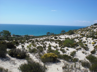
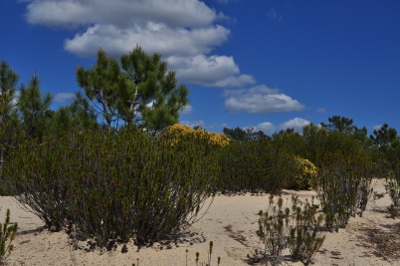
Wir verstehen Landschaften als gekoppelte  Mensch-Umwelt-Systeme. Sie  lassen sich beschreiben als Raumausschnitt, der sich auszeichnet durch das  Vorhandensein von physisch-materiellen  Elementen in einer  pezifischen Anordnung mit  dezidierten internen und externen Gesetzen und Abhängigkeiten sowie einer Wahrnehmungsrealität des Betrachtenden und dessen Wertverständnis. Landschaften unterscheiden sich daher vom Naturraum, durch die vom Menschen eingebrachte Intention und seinen Handlungswillen. Sie verfügen gleichsam über ein Potenzial, das der Mensch zu seinen Gunsten nutzen kann und welches in der  Vergangenheit vor allem in  Europa artenreiche Kulturlandschaften hervorgebracht hat. Vor allem durch demographischen Wandel, Ressourcennuutzung Wachstum und Globalisierung sind zahlreiche neue Drücke auf die Landschaften entstanden, welche eine tiefgreifende Veränderung in Gang gesetzt haben.

Das Ziel ist es, Veränderungen in der Landschaft zu erfassen, quantifizieren und zu deuten. Vor allem langfristige Entwicklungen und  mögliche kritische (Öko-)Systemzustände sollen auf Landschaftsebene frühzeitig erkannt werden können.

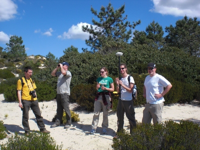
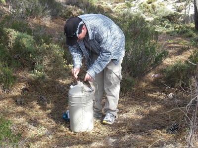
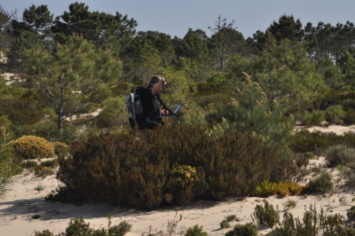
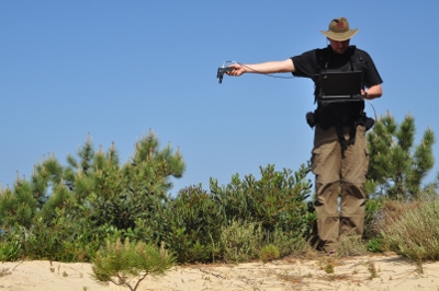
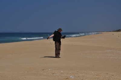
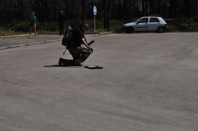
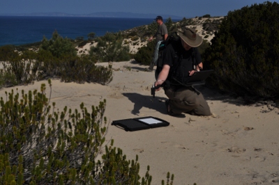
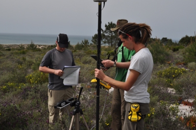
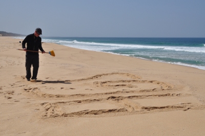
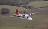
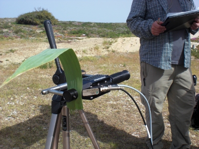
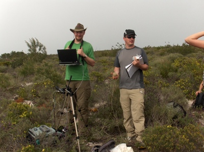
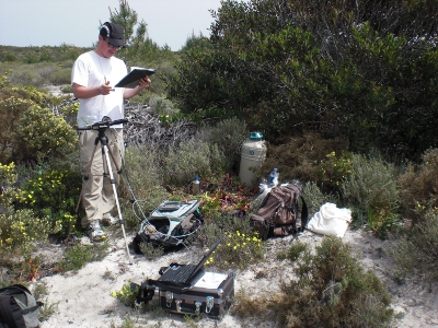
In diesem  Forschungsschwerpunkt wird  eine  breite Palette an Methoden eingesetzt. Zur  Analyse der  Umweltsysteme insbesondere  der räumlichen Erfassung  verwenden wir  hyperspektrale  Fernerkundung, Terrestrisches  Laserscanning, UAV und genaue GPS-Kartierungen, die wir in Geodateninfrastrukturen  verwalten und mit GIS analysieren. Zur  Untersuchung des Gesellschaftsystems praktizieren wir eine  gestufte  Vorgehensweise, welche in der Regel Akteurs- und Stakeholderanalysen, Institutionenanalyse und  Diskursanalysen  umfasst. Zur  besseren Vermittlung setzen wir  das DPSIR-Schema und andere  Rahmenmethodiken ein.

In unseren Projekten kooperieren wir international mit anderen Forschungsrichtungen, z.B. mit  der  Pflanzenökologie, der Photogrammetrie oder der Soziolologie.

  • Laufende Projekte

    Auswirkungen historischen Landnutzungswandels auf Artenreichtum und Zusammensetzung von Artengemeinschaften in fragmentierten und neu geschaffenen Habitaten (HiLUCC)

    Überleben am Rand?

  • Abgeschlossene Projekte

    QUEEN


    INSPECTED.NET


    DeInvader - Tracing the invasion of an exotic tree species in protected West-Mediterranean dune ecosystems

    Projektbeschreibung


    Imaging spectroscopy enables to derive a specific spectral signature for individual objects which can be used to identify chemical and structural characteristics of e.g. plant foliages within and across ecosystems. LiDAR data can be used to assess landscape structure and especially to analyse stratified vegetation structure. We want to combine hyperspectral and LiDAR data to detect the spread of the exotic tree Acacia longifolia that is an "invasive engineer" in Portuguese dune ecosystems. It is able to fix atmospheric nitrogen, to alter the water cycle and to transform the vegetation structure. This causes various problems in many ecosystems worldwide.
    To understand these ecosystem changes on landscape scale, precise data about A. longifolia distribution is necessary as baseline information. The invader occurs exposed to sky in the open dunes as well as in the undergrowth of dune forests. Local studies already show that it is able to facilitate its invasion by altering the ecosystem properties with negative impact on native and endemic species’ and biodiversity.
    This innovative approach of combining high resolution LiDAR and hyperspectral data is the appropriate way to track A. longifolia and to generate data of its distribution and impact on landscape scale.
    We conducted the flight campaign “DeInVader” in April 2011 along a 5x35km coastal strip 250km south of Lisbon in Southwest Portugal. The flight was arranged by the Airborne Research & Survey Facility of the Natural Environment Research Council (ARSF-NERC) using its Dornier 228 equipped with AISA Eagle and Hawk hyperspectral sensors, a Leica ALS50 LiDAR scanner and a digital camera. Thus, we collected aerial images, airborne LiDAR and hyperspectral data as well as field reference spectral and differential GPS vegetation data. The data of this flight campaign provided the basis for the DFG funded research project QUEEN and also contributes to the EU Marie-Curie-Project “Inspected.Net”.


    Finanzierung/Partner

    Die Flugkampagne wurde gefördert durch die European Facility for Airborne Research (EUFAR) , eine „Integrating Activity“ der Europäischen Kommission im 7.Forschungsrahmenprogramm. Innerhalb des „Transnational Access“-Programms von EUFAR wurde die Kampagne mit 9 Flugstunden und begleitender Geländearbeit (€ 46.000) gefördert.


    Diese Partner sind:


    Publikationen


    Oral presentations

    • Große-Stoltenberg A (2012) Invasão biológica de Acacia longifolia nos ecossistemas dunares de Portugal. Laboratory of Ecology and Evolution of Plants. Viçosa, Brazil.
    • Oldeland J, Hüttich C, Große-Stoltenberg A (2012) Plant ecology meets remote sensing: combined strengths for detailed vegetation mapping. ISUP. Bruges, Belgium.Lehmann J, Große-Stoltenberg A, Hellmann T, Oldeland J, Römer M (2012) Classification Model Development: Using Remote Sensing to Monitor the Spread of Invasive Plant Species Acacia longifolia. AK Fernerkundung. Bochum, Germany.
    • Große-Stoltenberg A, Oldeland J (2012) Wattle in the Hyperstack: Distinguishing an invasive Acacia  tree from native vegetation using hyperspectral vegetation indices and Self Organising Maps. Launch event for the Centre for Landscape and Climate Research. Leicester, UK.


    Poster contributions

    • Lehmann J, Große-Stoltenberg A, Hellmann T, Oldeland J, Römer M (2012) Development of a classification model based on field spectral and biochemical leaf properties to analyse Acacia longifolia invasion via remote sensing. Neobiota. Pontevedra, Spain.

    • Große-Stoltenberg A, Hellmann C, Thiele J, Lehmann J, Fernandes P, Antunes C, Burai P, Lenart C, Oldeland J, Máguas C, Buttschardt T, Werner C (2011) Detecting and analyzing the spread of exotic Acacia longifolia in West-Mediterranean biodiverse costal dunes with hyperspectral images and LiDAR. IALE-D. Berlin, Germany.

    • Große-Stoltenberg A, Hellmann C, Thiele J, Lehmann J, Fernandes P, Antunes C, Burai P, Lenart C, Oldeland J, Máguas C, Buttschardt T, Werner C (2011) Application of high resolution hyperspectral and LiDAR remote sensing to analyze the invasion of an exotic Acacia tree in Portuguese dune ecosystems. MEDECOS. Los Angeles, USA.


    Kontakt: Dipl.-Lök. André Große-Stoltenberg

  • Promotionen

    laufend

    Conservation Agriculture Natueco Elisabeth Mavrakis

    abgeschlossen

    Detection and Impact of an Invasive Ecosystem Engineer from Leaf to Landscape Scale Merging Field Spectroscopy and Remote Sensing with Ecophysiology André Große-Stoltenberg

    Understanding spatial growth and resilience of mega cities based on the DPSIR conceptual model. Study case: Greater Cairo Metropolis, Egypt  Ahmed Hassan

    Water-Saving in the Landscapes and Lifeworlds of Khorezmian Farmers, Uzbekistan Lisa Oberkircher

  • Publikationen

    • Thiele, J.; Buchholz, S.; Schirmel, J. (2017): Using resistance distance from circuit theory to model dispersal through habitat corridors. Journal of Plant Ecology. doi: 10.1093/jpe/rtx004
    • Schirmel, J; Thiele, J.; Entling, M.H.; Buchholz, S. (2016): Trait composition and functional diversity of spiders and carabids in linear landscape elements. Agriculture, Ecosystems and Environment 235: 318–328 doi: 10.1016/j.agee.2016.10.028.
    • Große-Stoltenberg A., Hellmann C., Werner C., Oldeland J., Thiele J. (2016): Evaluation of Continuous VNIR-SWIR Spectra versus Narrowband Hyperspectral Indices to Discriminate the Invasive Acacia longifolia within a Mediterranean Dune Ecosystem. Remote Sensing. 2016, 8(4): 334 doi:10.3390/rs8040334
    • Lehmann, J.R.K*.; Münchberger*, W.; Knoth, C.; Blodau, C.; Nieberding, F.; Prinz, T.; Pancotto, V.A.; Kleinebecker, T. (2016): High-Resolution Classification of South Patagonian Peat Bog Microforms Reveals Potential Gaps in Up-Scaled CH4 Fluxes by use of Unmanned Aerial System (UAS) and CIR Imagery. Remote Sens. 2016, 8, 173. doi:10.3390/rs8030173 *(gleichberechtigte Autorenschaft)
    • Lehmann, J.R.K., K. Z. Smithson, T. Prinz (2015): Making the Invisible Visible: Using UAS-Based High-Resolution Color-Infrared Imagery toIdentify Buried Medieval Monastery Walls.” Journal of Unmanned Vehicle Systems. doi:10.1139/juvs-2014-0017 .
    • Hellmann C, Große-Stoltenberg A, Lauströer V, Oldeland J and Werner C (2015). Retrieving nitrogen isotopic signatures from fresh leaf reflectance spectra: disentangling δ15N from biochemical and structural leaf properties. Front. Plant Sci. 6:307Front. Plant Sci. doi: 10.3389/fpls.2015.00307 
    • Lehmann, J.R.K.; F. Nieberding, T. Prinz, C. Knoth (2015): Analysis of Unmanned Aerial System-Based CIR Images in Forestry - A New Perspective to Monitor Pest Infestation Levels. Forests 2015, 6, 594-612. doi: 10.3390/f6030594
    • Lehmann, J.R.K., A.Große-Stoltenberg, M. Römer, J. Oldeland, J. (2015): Field Spectroscopy in the VNIR-SWIR Region to Discriminate between Mediterranean Native Plants and Exotic-Invasive Shrubs Based on Leaf Tannin Content. Remote Sens. 2015, 7, 1225-1241. doi:10.3390/rs70201225
    • Oberkircher, L., A. Haubold, C. Martius, T.K. Buttschardt (2012): Patterns in the Landscape of Khorezm, Uzbekistan: A GIS Approach to Socio-Physical Research. In: Martius, C., I. Rudenko, J.P.A. Lamers, C. Martius (eds.)(2011): Cotton, Water, Salts and Soums. Springer, Dordrecht, Heidelberg, London, New York: 285-308
    • Rascher K G, Große-Stoltenberg A, Máguas C, Meira-Neto J A A, Werner C (2011): Acacia longifolia invasion impacts vegetation structure and regeneration dynamics in open dunes and pine forests. Biological Invasions 13: 1099-1113
    • Buttschardt, T.K. (2011): Creeping Disasters als Folge schleichender Umweltveränderungen? – ein Konzeptvorschlag. GMit 45(9): 6-17
    • Rascher K G, Große-Stoltenberg A, Máguas C, Werner C (2011): Understory invasion by Acacia longifolia alters the water balance and carbon gain of a mediterranean pine forest.In: Ecosystems.
  • Abschlussarbeiten

    Bachelorarbeiten

    Titel Name Jahr
    Review: Where have all the Wattles gone? Vergleich von Ansätzen zum
    Monitoring von Acacia-Beständen per Fernerkundung
    Julia Schiller 2012
    Sind Exoten einfach entspannter? Vergleich der Konzentration von Tannin als Abwehrstoff in Blättern exotischer invasiver und einheimischer Baum- und Straucharten Maria Magdalena Düsing 2012
    Vegetationskundliche Kartierung des ehemaligen Standortübungsplatzes
    Flamschen bei Coesfeld und eine Fundpunktkartierung ausgewählter Rote-
    Liste-Arten – Schwerpunkt: Pflanzengesellschaften
    Simon Kellner 2011
    Vegetationskundliche Kartierung des ehemaligen Standortübungsplatzes
    Flamschen bei Coesfeld und eine Fundpunktkartierung ausgewählter Rote-
    Liste-Arten – Schwerpunkt: Rote-Liste-Arten
    Henrike Ruhmann 2011
    Erfassung und Risikobewertung invasiver Arten beim Standortübungsplatz Flamschen, Coesfeld. Fundpunktkartierung von Fallopia japonica und Prunus serotina mittels differentiellem GPS Judit Hejkal 2011
    Experimenteller Vergleich von Lachgasemissionen aus zwei verschieden gedüngten Bodenproben Nicola Deipenbrock 2011
    Die Lachgasemissionen landwirtschaftlicher Nutzflächen: Eine Übersicht über die Gewichtung der relevanten Parameter
    (Zusammenfassung)
    Florian Hackmann 2011
    Erfassung eines Kreuzkrötenvorkommens auf einer Bodendeponie in Coesfeld-Flamschen
    (Zusammenfassung)
    Annika Baron 2010
    Erfassung einer Zauneidechsenpopulation mittels fotografischer Wiedererkennung
    (Zusammenfassung)
    Benjamin Bleyhl 2010
    Bestandsaufnahme des ökologischen Zustandes der renaturierten Berkel in Billerbeck. Evaluation der Ziele des ökologischen Ausbaus der Berkel.
    (Zusammenfassung)
    Jeannine Böhmichen 2010
    LEAVES – Laser scanning Experiment to Analyse the Variances of tree leaves Surface reflectance
    (Zusammenfassung)
    Florian Hertenstein 2010
    Neue Wege in der Kartierung des Feldhamsters (Cricetus cricetus). Ist das Monitoring mittels Fernerkundung eine Alternative? Philipp Keller 2010
    Die Entwicklung der Siegerländer Hauberge mit Auswirkungen auf das Haselhuhn (Bonasa bonasia)
    (Zusammenfassung)
    Carmen Toews 2009

    Masterarbeiten

    Titel Name Jahr
    Untersuchungen zur Aktivität und Habitatnutzung von Fledermäusen (Microchiroptera) in Nordrhein-Westfalen Ralph-Michael Dowe 2014
    Identification of Acacia species based on spectral properties and Tannin concentration in South Portugal
    (Abstract)
    Jan Lehmann 2012

Fotos

Team of the field campaign: Peter Burai, Csaba Lenart (both Karoly Robert University College), Christine Hellmann (Universität Bielefeld/Bayreuth), Jan Lehmann, André Große-Stoltenberg (both Universität Münster); Missing: Cristina Antunes (Universida
  • Freezing of biomass samples in liquid nitrogen for later extraction chlorophyll in the lab (Photo: Jens Oldeland)
  • Collecting the canopy spectral signature of the canopy of the endemic Portuguese Crowberry Corema album (L.) D. Don using an ASD Fieldspec with pistol grip (Photo: Peter Burai)
  • Collecting the canopy spectral signature of the canopy of the invasive Sydney Golden Wattle Acacia longifolia (Andrews) Willd. Don using an ASD Fieldspec with pistol grip (Photo: Peter Burai)
  • Collection of soil spectral signature using an ASD Fieldspec with pistol grip (Photo: Peter Burai)
  • Collection of asphalt spectral signature for later atmospheric correction of the airborne hyperspectral data using an ASD Fieldspec with pistol grip (Photo : Peter Burai)
  • Collecting white reference measurements during field spectral sampling to account for alterations of illumination and atmospheric conditions (Photo: Peter Burai)
  • Ground truthing of vegetation using a highly accurate differential GPS device (Photo: Peter Burai)
  • Cleaning-up and sweeping the beach after a hard day’s work (Photo: Peter Burai)
  • The Dornier 228 aircraft operated by the Airborne Research & Survey Facility of the Natural Environment Research Council (ARSF-NERC) that collected the airborne data of the flight campaing (Photo: ARSF-NERC)
  • Coastal dunes in Pinheiro da Cruz, SW Portugal, in the northern part of the area of study (Photo: Jens Oldeland)
  • Dunes dominated by the endemic Portuguese Crowberry Corema album (L.) D. Don in Pinheiro da Cruz, SW Portugal, in the northern part of the area of study (Photo: Peter Burai)
  • Test measurements of leaf spectra with an ASD Fieldspec and a leaf clip device (Photo: Peter Burai)
  • Close-up of ASD Fieldspec with leaf clip device (Photo: Jens Oldeland)
  • Leaf spectral measurements at the field site using an ASD Fieldspec with leaf clip device (Photo: Cristina Antunes)
  • Leaf spectral measurements at the field site using an ASD Fieldspec with leaf clip device in front of an invasive Sydney Golden Wattle Acacia longifolia (Andrews) Willd. (Photo: Jens Oldeland)