
“In the mornings, you can usually leave your umbrella at home”
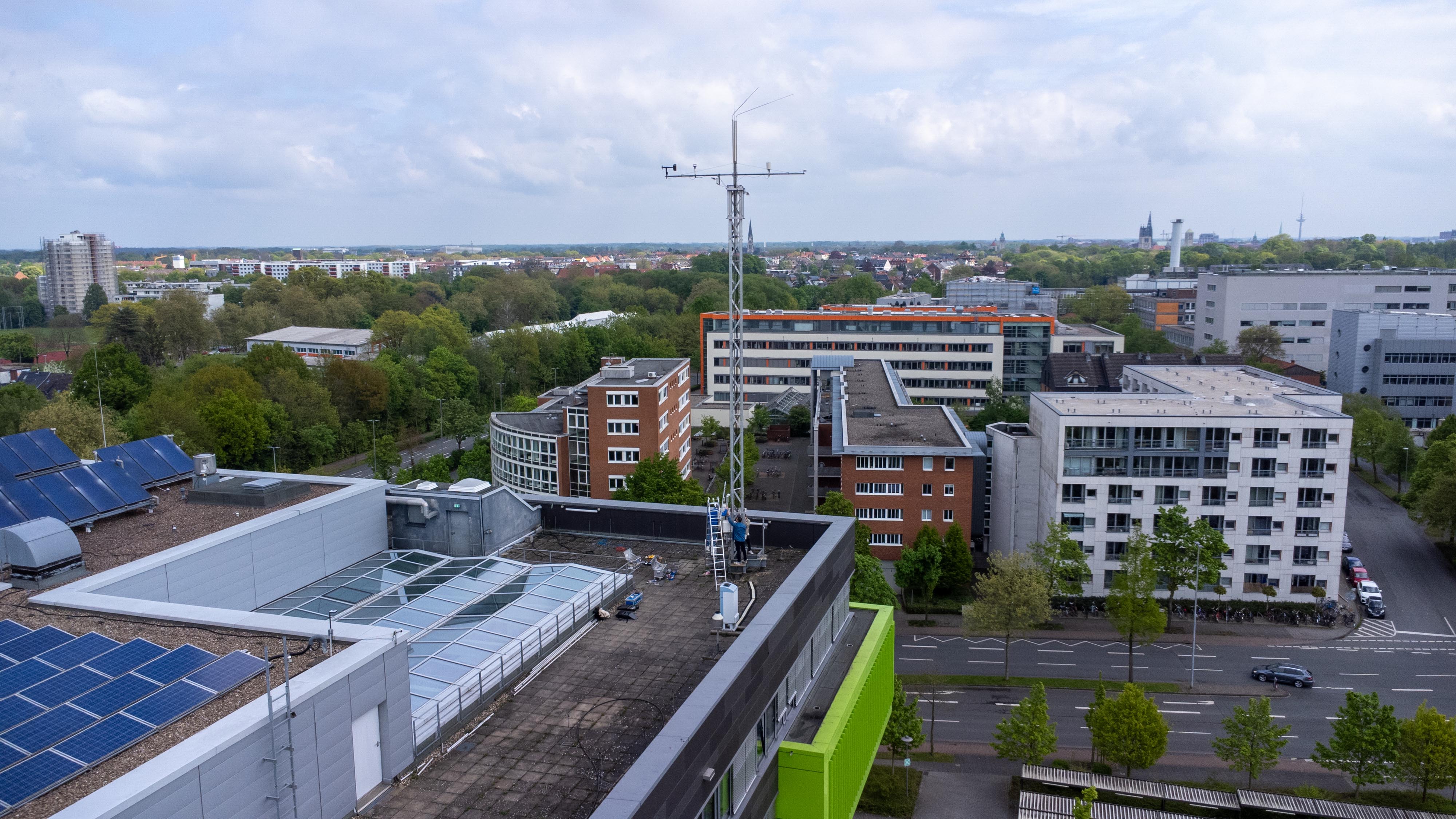
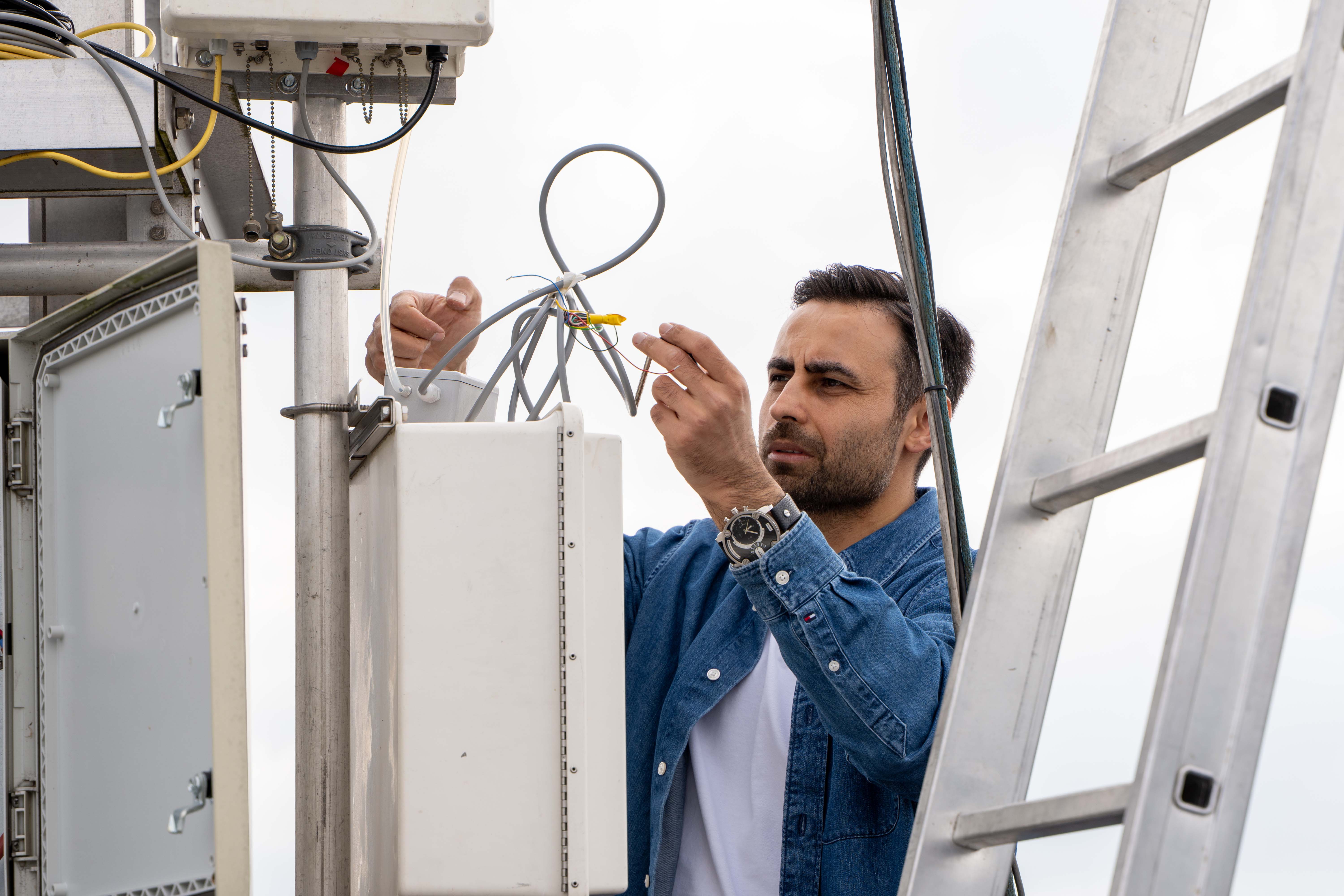
In Münster it rains, or the bells ring, as the saying goes. Some people even whisper that Münster is one of the rainiest cities in Germany. How much truth is there to this? Since 2014, a long-term measurement tower on the roof of the GEO1 building at the University of Münster has been monitoring so-called climate variables continuously every ten minutes. The statistics based on these measurements provide valuable insights into the weather conditions in our city. In an interview with Julia Harth, Dr Toprak Aslan, a micrometeorologist from the research group “Biosphere-Atmosphere Interaction” explains why the weather in Münster is the way it is, and why you might need an umbrella more in the evening.
We’ve now got the first heatwave of the summer behind us. How has the summer heat developed since the beginning of your records in 2014?
The measurements do not indicate a simple year-to-year increase in summer heat from 2014 to 2025. Instead, warm summers and heatwaves appear episodically, with substantial variability between years. This highlights the complexity of urban summer climate conditions and the importance of continuous long-term observations. The most hot days, with temperatures above 30 degrees, occurred in 2019 with 14 days. Globally, climate change is contributing to increasing temperatures and more frequent heat extremes, including urban areas. At the same time, cities themselves are highly heterogeneous and continuously evolving environments. Local factors such as building density, vegetation cover, surface materials, ventilation pathways, and ongoing urban development can strongly influence the thermal conditions measured at a specific location.
On 25 July 2019, the temperature in Münster was 37.6 degrees at 4 pm. We have already come very close to this record this summer: on 26 and 27 June, we recorded 37.3 degrees at 5 pm. Incidentally, the lowest temperature we have recorded over the past twelve years during the summer months of June to August was 7.1 degrees at 5 am on 9 June 2015.
And what about the temperatures at night?
While 30 degrees is often considered a psychological threshold for daytime heat discomfort, tropical nights are commonly used to characterize night-time heat stress. A tropical night is defined as a night during which the minimum air temperature does not fall below 20 degrees. Similar to hot days, the number of tropical nights from 2014 to 2025 does not increase continuously – there are considerable fluctuations from year to year. In the years 2019, 2020 and 2022, there were relatively frequent such warm nights.
Are there any particular features of the weather in Münster compared to other conurbations in Germany?
Unlike what many people think or claim, Münster is not one of the rainiest areas in Germany. This perception is likely influenced by the relatively frequent occurrence of cloudy and unsettled weather, which is associated with the maritime influence of Western Europe.
But it does rain relatively often in the afternoon in Münster, doesn't it?
The observations show that between 12pm and midnight, 32% more rain falls than in the first half of the day. Especially in the late afternoon hours between 4pm and 7pm, an average of about a quarter of the daily precipitation falls. This 'afternoon peak' is not an inherent feature of a maritime climate, but rather a classic land-based (continental) summer phenomenon interacting with marine moisture. Since Münster is relatively close to the North Sea and the Atlantic, moist maritime air masses frequently flow over the region. When this moist air moves over the continent, the daily solar radiation acts as a trigger.
What does this mean concretely?
In the morning, solar radiation heats the ground and creates thermal instability as the warm surface heats the lowest layer of air, making it less dense than the cooler air above it. This buoyant air rises in upward currents, called thermals. As the air ascends, it cools, and the abundant maritime moisture condenses into cumulus clouds. Throughout the day, continuous heating from the ground feeds these updrafts, causing the clouds to grow into large cumulonimbus (thunderstorm) clouds. By the late afternoon, this instability peaks; the upward currents can no longer support the weight of the accumulated water droplets, causing the clouds to collapse internally and release heavy downpours.
Can a practical insight be derived from this?
The data provides an excellent guide for daily commute. If you have something to do at 9am, you can usually leave the umbrella at home. However, it is advisable to pack an umbrella for activities in the late afternoon and evening.
How dry or wet were the summers in the past twelve years in Münster?
Over this period, the average annual rainfall was 715.7 millimetres. However, there are big differences from year to year. The wettest overall year was 2017, when a lot of rain outside of summer pushed the total amount to over 1100 millimetres. In contrast, 2018 was a dry year with less than 500 millimetres of precipitation. If you only look at the summer months of June, July and August, the differences are also clear. The wettest summer was 2014, when over 400 millimetres of rain fell, which is more than half of the annual precipitation. The driest summer was 2022 with less than 100 millimetres. You can see: The annual precipitation amounts in Münster differ considerably.
What does the future hold for the GEO1 weather station? Can the public access this data?
Yes, absolutely! Our measurement data is automatically updated every 10 minutes and is freely available to everyone on our website. Users can view real-time figures covering the last 24 hours, 5 days, and 20 days. The data is already widely used by researchers, students, and local authorities. Our main goal is to continue these measurements without interruption into the future. However, the budget on which we run this tower is coming to an end. We hope that we can secure enough funding to maintain this infrastructure and continue these vital climate measurements for the city of Münster.