WWU MünsterInstitute of Landscape EcologyRemote Sensing and Spatial Modelling Research Group
  • zum Inhalt
  • zur Hauptnavigation
  • zur Subnavigation
  • de
  • en
  • Home
  • Team
  • Teaching
  • Research
  • Publications
  • Home
    • Team
      • Maite Lezama Valdes
  • Prof. Dr. Hanna Meyer
  • Dr. Jan Lehmann
  • Maite Lezama Valdes
  • Marvin Ludwig
  • Maiken Baumberger
  • Laura Giese
  • Henning Schneidereit
  • Student Assistants
  • Guests
  • Alumni
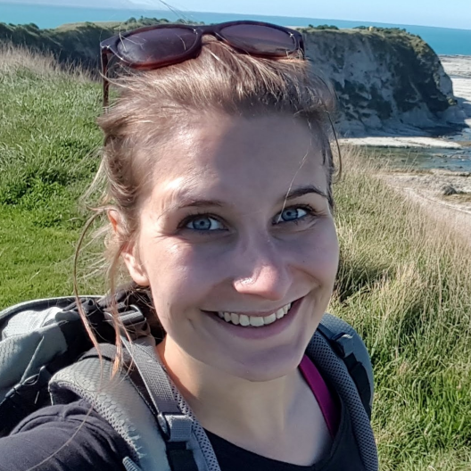
Profile picture of Maite Lezama Valdes
© Maite Lezama Valdes

Maite Lezama Valdes

Remote Sensing and Spatial Modelling Research Group
Institute of Landscape Ecology
Heisenbergstr. 2, D-48149 Münster
room 546
phone +49(0)251-83 33 679
e-mail maite.lezama [at] wwu.de

office hours on appointment

  • Research Areas

    • Downscaling
    • machine learning
    • remote sensing
  • CV

    Education

    2016 - 2019
    MSc Physical Geography Philipps Universität Marburg
    2015 - 2018
    MA Soziologie und Sozialforschung Philipps Universität Marburg
    2014 - 2016
    BSc Geography Philipps University Marburg
    2011 - 2015
    BA Social Sciences Philipps Universität Marburg

    Positions

    since 11.​2019
    Doktorandin am Institut für Landschaftsökologie Münster
    04.​2019 - 10.​2019
    PhD candidate Institute for Geoinformatics Münster
  • Teaching

    • Übung: Ü Ecological data analysis and visualization with R [142697]
      [06.04.2023 - 13.07.2023 | 12:00 - 14:00 | wöchentlich | Do. | StudLab GEO1 130 | Lilian-Maite Lezama Valdes]
  • Publications

    Research articles (journals)

    2021
    • Lezama Valdes M; Katurji M; Meyer H. 2021. ‘A Machine Learning Based Downscaling Approach to Produce High Spatio-Temporal Resolution Land Surface Temperature of the Antarctic Dry Valleys from MODIS Data.’ Remote Sensing 13, No. 22. doi: 10.3390/rs13224673.
    2019
    • Ludwig M, Morgenthal T, Detsch F, Higginbottom TP, Lezama Valdes M, Nauß T, Meyer H. 2019. ‘Machine learning and multi-sensor based modelling of woody vegetation in the Molopo Area, South Africa.’ Remote Sensing of Environment 222: 195 – 203. doi: 10.1016/j.rse.2018.12.019.

    Abstracts as ePaper (Conferences)

    • Lezama Valdes M; Katurji M; Meyer H. ‘Downscaling Land Surface Temperature for the Antarctic Dry Valleys using Multi-Sensor Data and Machine Learning.’ contributed to the EGU General Assembly 2019, Wien, Österreich, 2019.
    Top of page

    Contact

    University of Münster
    Remote Sensing and Spatial Modelling Research Group

    Heisenbergstraße 2
    D-48149 Münster

    Tel: +49(0)251-83 30 097
    Fax: +49(0)251-83 38 338
    hanna.meyer [at] wwu.de
     
    living.knowledge
    • Legal Disclosure
    • Privacy Statement
    • Accessibility

    © 2023 Remote Sensing and Spatial Modelling Research Group - Institute of Landscape Ecology - WWU Münster