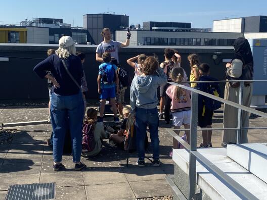
As part of the “Earth, Air, and Water” theme week, several elementary school students visited our rooftop station on the GEO1 building at the University of Münster. Our long-time student assistant, Joshua Gerkens, told the students about the weather, climate, and some of the measuring instruments. Interest was high despite the summer break. Maybe we’ll see some of them in the lecture hall in a few years.
You can find the latest data from our weather station here.
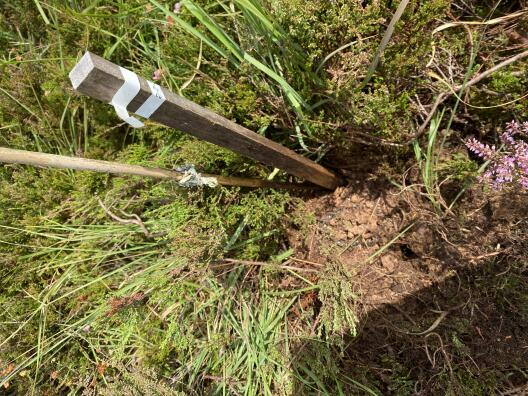
Our Bachelor student Jonna had her first fieldwork day for her Bachelor thesis. The goal is to extract root ingrowth cores from two peatlands, analyse the root biomass and measure the total carbon content.
On the first fieldwork day she extracted the first root cores at our permanent research station in Amtsvenn together with two of our research assistants. The root cores were refilled to be analysed continuously.
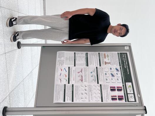
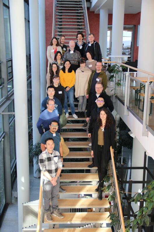
This semester the BAI group contributed with one presentation and one poster to the graduate conference at our institute. Our PhD student Yu Luo presented a poster on “Global tree water-use patterns under climate change”. He found that transpiration is a critical process coupling the water, carbon, and energy cycles, and quantifying it is central to water and forest management. Because measurements are available only at discrete points, machine learning (ML) offers a way to produce continuous gridded estimates, while explainable AI (XAI) can reveal the drivers of transpiration across space and time under climate change.
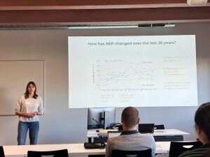
Our Bachelor student Jana Schwark presented her Bachelor thesis entitled “Balancing Efficiency and Emissions: The Role of Artificial Intelligence in the Climate Debate and Its Perception Among Students”. In her work Jana did a survey on the usage of AI in a university context and how much students know about the environmental impact of AI.
New paper: Timing and intensity of warming matters
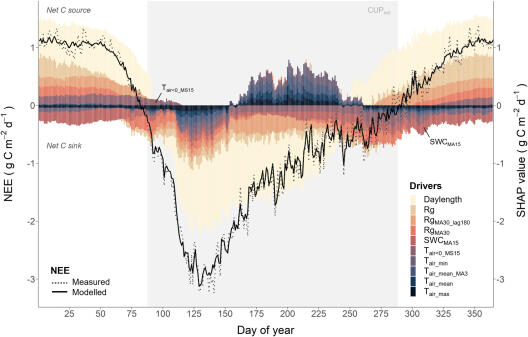
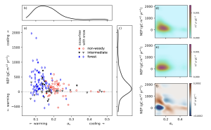
Our PhD student Nicolas Behrens published the first paper of his thesis in Biogeosciences. In the paper entitled “The timing of warming matters as much as its intensity for the annual carbon balance of a degraded raised bog” they used 3 years of greenhouse gas fluxes in a drained shrub-dominated ombrotrophic raised bog in Germany. The findings illustrate that fluxes from drained bogs are variable and the timing of climate anomalies is crucial for their impact on carbon fluxes.
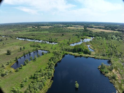
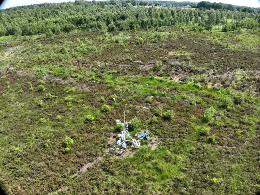
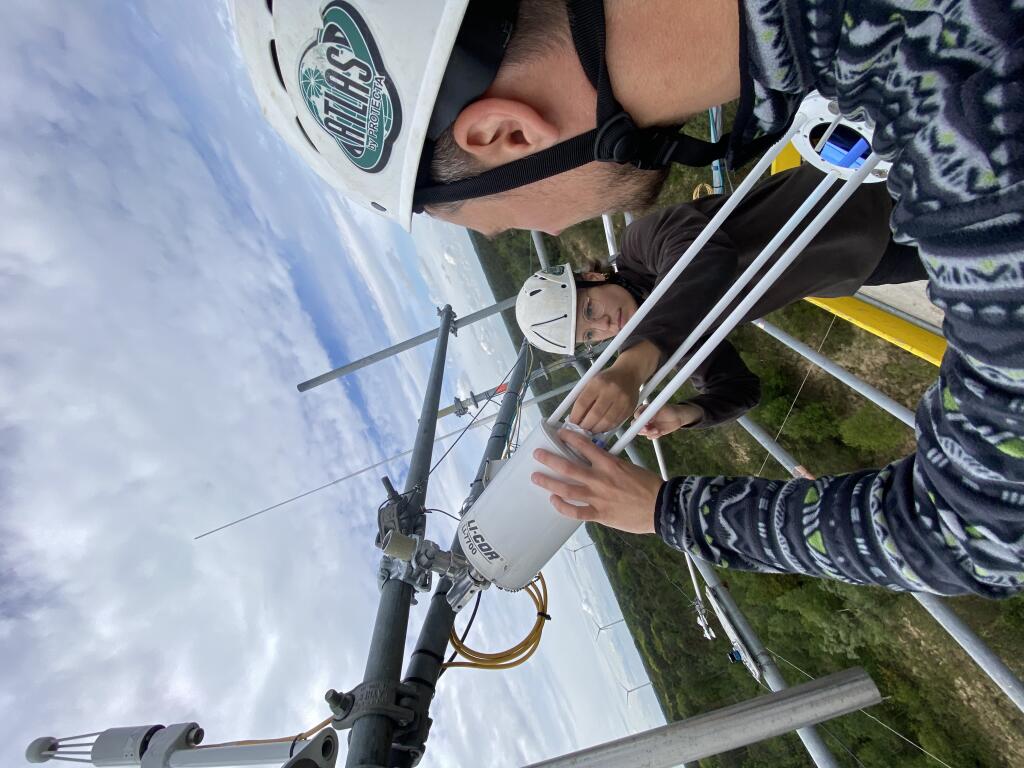
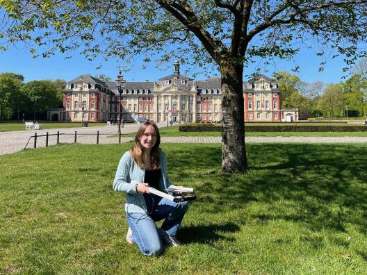
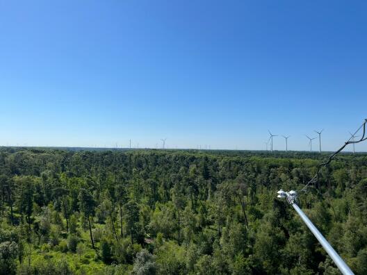
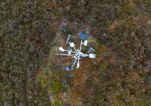
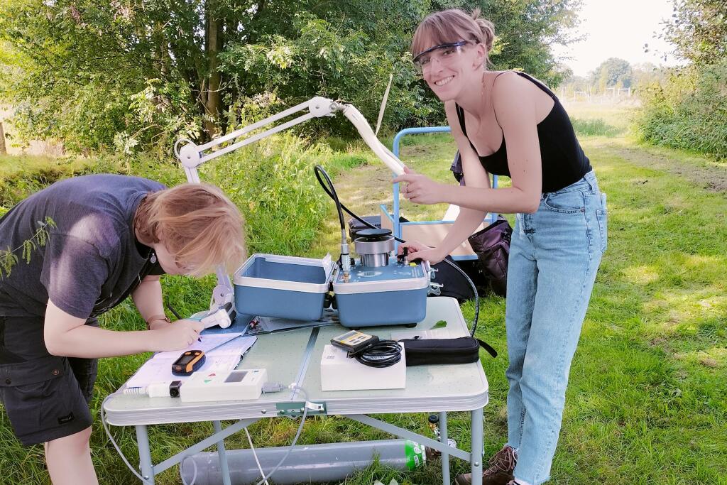
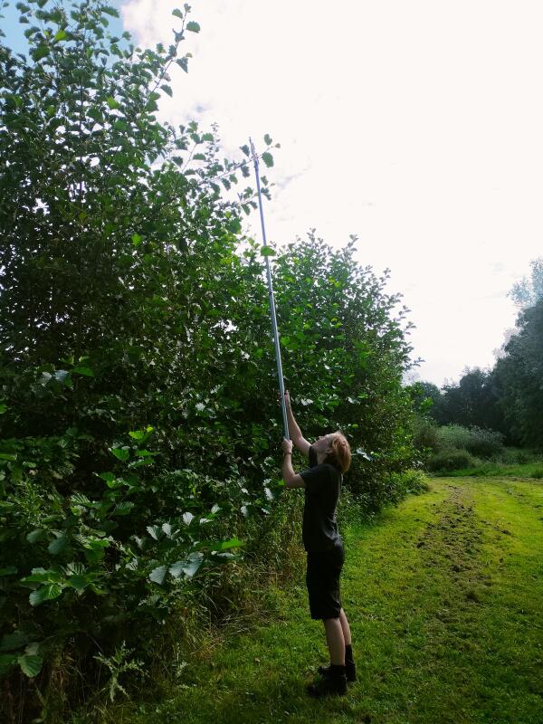
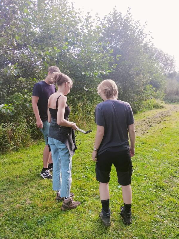
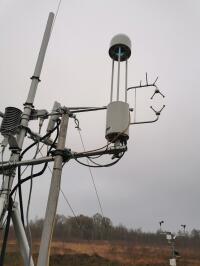
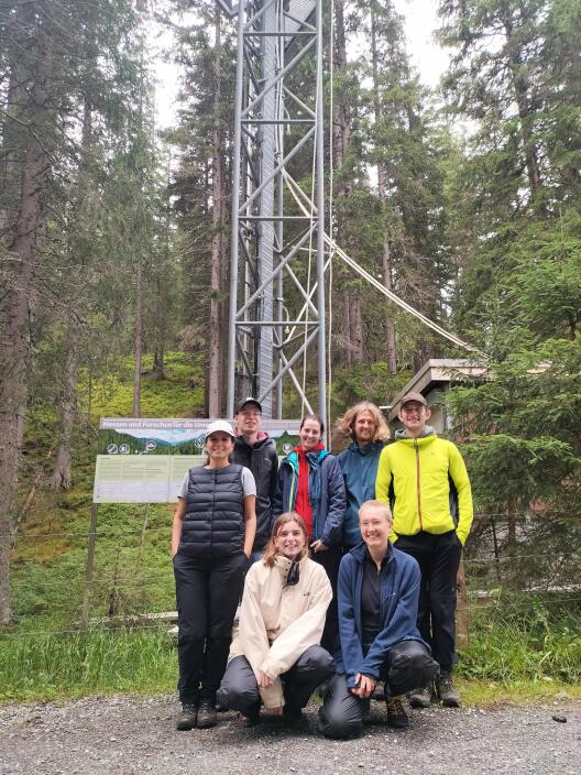
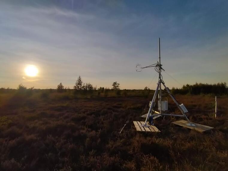
The rpoject of our new postdoc Dr. Isadora Gerheim addresses the upscaling of greenhouse gas (GHG) flux estimates in peatland ecosystems across spatial scales by integrating high-resolution field and unmanned aerial vehicle (UAV) measurements with broader-extent satellite imagery, and machine learning models to map fine-scale flux relationships across the wider landscape. The aim is to understand the relationship between GHG fluxes and landscape characteristics, spatializing the flux measurements across the peatland. Isadora joined the University of Münster in June 2026, and the first UAV campaign was conducted at the end of July. This flight marks the beginning of a series of aerial surveys planned over the course of her postdoctoral project which runs until May 2028. The campaigns are carried out in collaboration with Dr. Jan Lehmann, of the Remote Sensing and Spatial Modelling Research Group at the Institute of Landscape Ecology of the University of Münster. The images shown here were acquired during this first field campaign.
"In the mornings, you can usually leave your umbrella at home" - Interview with Toprak Aslan
Following the first heat wave of the year, Toprak Aslan was interviewed about the weather in Münster. In the interview, he explains how the weather has changed over the past 20 years, based on weather records from the university building, and when we should bring an umbrella.
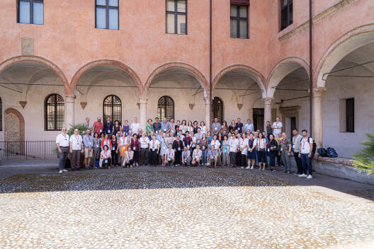
The final annual meeting of the COST Action project CLEANFOREST took place between 16 and 18 June in Bologna, Italy. Many project partners joint from institutions across Europe. During the meeting Mana reported on the activities of the WG3 and particularly the recent perspective paper published in Forest Ecology Management (link).
“Summer in Transition” – Article in the university newspaper wissen|leben
Nora Fried and Toprak Aslan contributed articles to the “Summer in Transition” feature in the university newspaper wissen|leben. Nora was interviewed about heat waves and our perception of summer. We’re experiencing more hot days in Germany (days above 30 °C), and 2024 was the warmest year on record globally. You can read the full interview here.
Toprak also analyzed data from the university’s GEO1 weather station, which has been in operation since 2014. The hottest day on record was July 25, 2019, with a temperature of 37.6 °C. The full feature page, with additional articles on urban planning and animal ecology, can be found here.
This year Nora Fried won the Department of Geosciences teaching award! This is a great distinction for lecturers and reflects outstanding teaching skills. Congratulations Nora!
New Paper: Europe's forests under multiple pressure
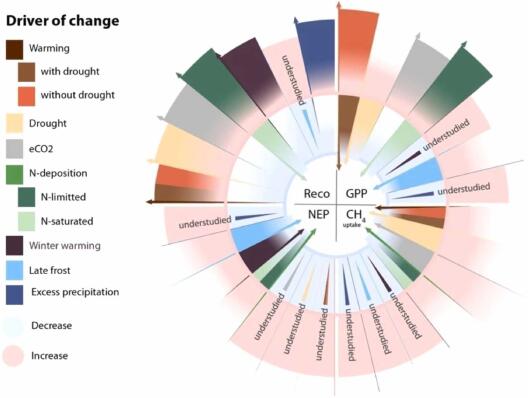
Mana published a new paper about the status of European forests. The study, a perspective literature review, was conducted as part of the European COST Action CLEANFOREST, which brought together 34 researchers from 30 institutes across 17 countries.
The authors emphasise that the best opportunity to understand the complex effects of multiple global change drivers on forest functioning and to make more realistic predictions for the future lies in long-term observations under field conditions combined with data science and statistical approaches.
Read the full paper here. Click here to read the article about the paper published on the university website.
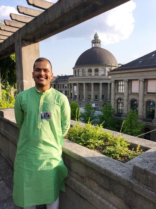
Warm Welcome to Isadora Gerheim
Welcome to Isadora Gerheim, our new postdoctoral researcher and Alexander von Humboldt Fellow! Isadora joins our group from the Federal University of Viçosa and will be focusing on remote sensing over the next two years.
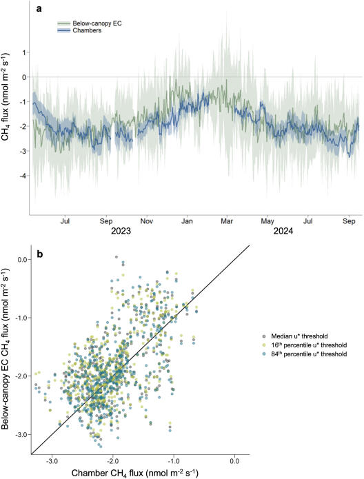
New Paper: Below- and above-canopy methane and nitrous oxide fluxes in a subalpine spruce forest
As part of her PhD research, Luana published work on understanding methane and nitrous oxide exchanges in a subalpine spruce forest in Davos using a seven-year time series. She found that the forest was a small methane source with a forest-floor methane sink. The methane fluxes were controlled by snow depth, soil climate and light. Nitrous oxide fluxes were very small. Finally, she found that the forest remained a net greenhouse gas sink.
Our measurement tower in Lüntener Wald has been equipped with a new sensor. In addition to meteorological data and CO2 fluxes, the tower can now also record methane. The device was installed at a height of 30 meters at the top of the tower and, as part of the eddy covariance setup, measures the methane concentration in the eddies.
This allows methane emissions from the peatland forest to be recorded and analyzed before, after, and during the rewetting of the peatland forest.
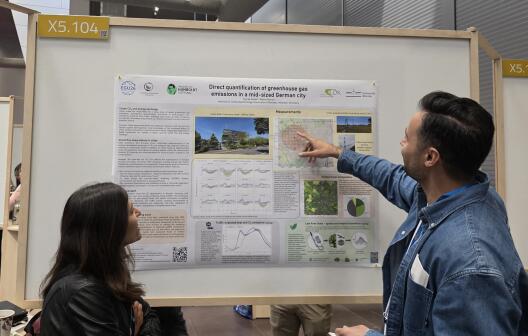
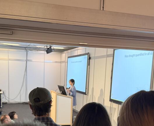
Our group joined this year’s EGU in Vienna with several contributions. Our Alexander von Humboldt Fellow Toprak Aslan presented his newest results on the direct quantification of greenhouse gas emissions in the City of Münster (EGU26-5654). Our postdoc Yu Zhou (co-hosted at ETH) gave a presentation on the regulation of European ecosystem productivity (EGU26-4793). Mana Gharun gave a presentation on the definitions of droughts and how they shape our understanding of the forest responses to drought (EGU26-19476). She was also leading a session on “Novel methods for bridging understanding of carbon, nitrogen, and water fluxes from leaf to continental scales” (BG2.4). They all come back with lots of new ideas for future projects and collaborations.
Field campaign in the city of Münster
Lena Brauer is currently writing her bachelor’s thesis with Prof. Dr. Mana Gharun and Dr. Toprak Aslan on the seasonal dynamics of Leaf Area Index (LAI) - a critical measure of leaf surface area that scales the exchange of CO2, water vapor, and energy between urban vegetation and the atmosphere.
Because urban green spaces are highly fragmented and diverse, Lena’s work emphasizes the necessity of high spatial and temporal resolution. Accordingly, the fieldwork is conducted weekly from April to June 2026 and covers eight representative locations, focusing on deciduous trees and low vegetation & shrubs. LAI is quantified by three distinct methodologies: (1) indirect in-situ sensing via LI-COR LAI-2200C Plant Canopy Analyzer, (2) optical analysis using full-frame canopy photography, (3) remote sensing via Sentinel-2 satellite imagery, enabling a thorough assessment of the strengths and shortcomings of different LAI estimation techniques in a heterogeneous urban environment.
Lena’s findings will provide essential in-situ data for the MUSE project (Münster Urban Surface-atmosphere Exchange). By integrating her seasonal LAI values into the SUEWS (Surface Urban Energy and Water Balance Scheme) modeling framework, the thesis contributes to a more accurate bottom-up representation of urban energy and CO2 exchange. This work is vital for partitioning biogenic and anthropogenic carbon contributions, ultimately supporting Münster’s progress toward climate neutrality.
Warm Welcome to Luis Espinosa
Welcome to Luis Espinosa who is visiting our group within the project CLEANFOREST. Luis is a postdoctoral researcher at the University of Porto (FEUP). He won a virtual mobility grant to carry out a project with Mana within the project CLEANFOREST and will focus on characterisation of drought across forests.
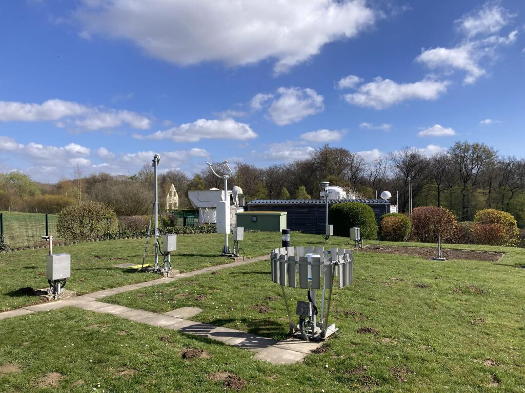
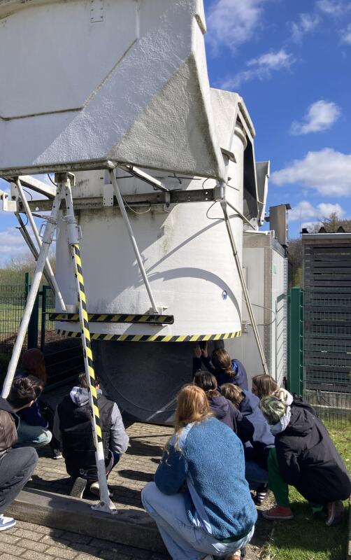
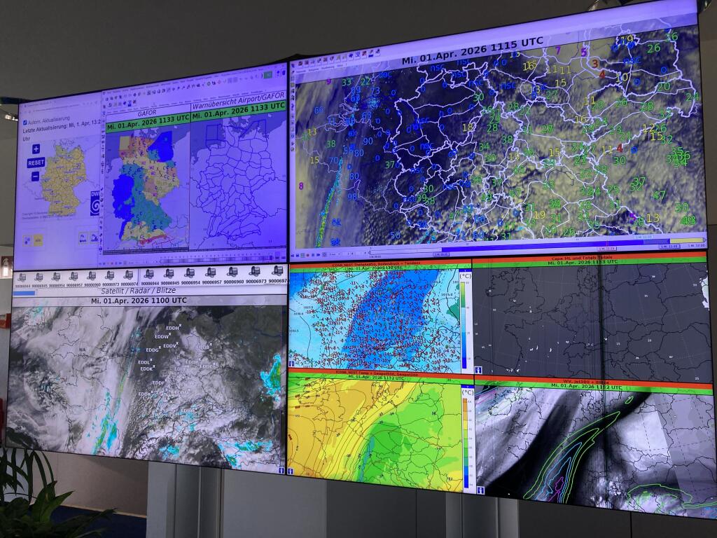
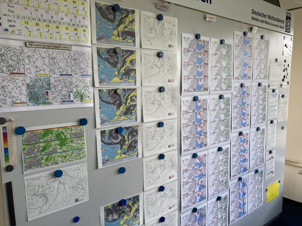
Together with a group of 15 students from the Landscape Ecology and Geography programmes, we visited the German Weather Service (DWD) site in Essen. We visited the DWD’s observation field, including the daily radiosonde launch, were allowed to attend the daily briefing on land and aviation weather, and finally gained an insight into the Climate Office at the DWD. It was very exciting to experience weather observations up close.
Many thanks to the DWD team, we’d love to come back!
Two Master theses detect illegal landuse using satellite imagery
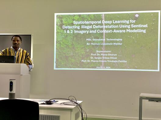
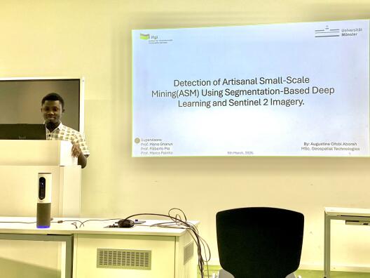
Our two Erasmus students Thomas and Augustine successfully completed their Master theses on illegal land use using satellite imagery. Both of their projects were a collaboration between the University of Münster, NOVA Information Management School, Lisboa, Portugal and the Universitat Jaume I, Castellón, Spain. Thomas’ thesis with the title “Spatiotemporal Deep Learning for detecting illegal deforestation using Sentinel 1 and 2 Imagery and context-aware modelling” demonstrates the importance of satellite imagery and deep learning approaches in detecting illegal deforestation and assessing the legality of forest harvest activities. Augstines’ thesis “Detection of Artisanal Small-Scale Mining (ASM) Using Segmentation-Based Deep Learning and Sentinel 2 Imagery in Madre de Dios, Peru” reveals that deep learning in combination with satellite imagery can help with the detection of Artisanal and Small-Scale Mining.
Congrats, Thomas and Augustine!
Workshop on Eddy Covariance measurements of methane and nitrous oxide
Mana and Toprak joined the workshop "Advance methane and nitrous oxide modelling via standardized flux monitoring and data processing" in Hannover to exchange on latest advances in modelling and measuring CH4 and N2O fluxes across diverse ecosystem types. The event was organised by MPI BG supported by the Volkswagen Stiftung.
The group of Bart Kruijt from the Earth Systems and Global Change Research Unit of the University of Wageningen from The Netherlands, visited our eddy covariance stations in Amstvenn and the Lünten forest today. Lots of ideas were exchanged for cross-border collaborations between the two research groups, and it was a beautiful day to enjoy the nature.
The LWL museum published a video on the collaborative project in the Lünten forest between the University of Münster, the LWL Museum and the LWL Bau- und Liegenschaftsbetrieb. It is a very nice animation of the huge project that is going on in this special forest. Can you spot some ILÖK members in the video?
In this project the AG BAI takes care of the huge eddy-covariance tower to better understand the interaction between the forest and the atmosphere.
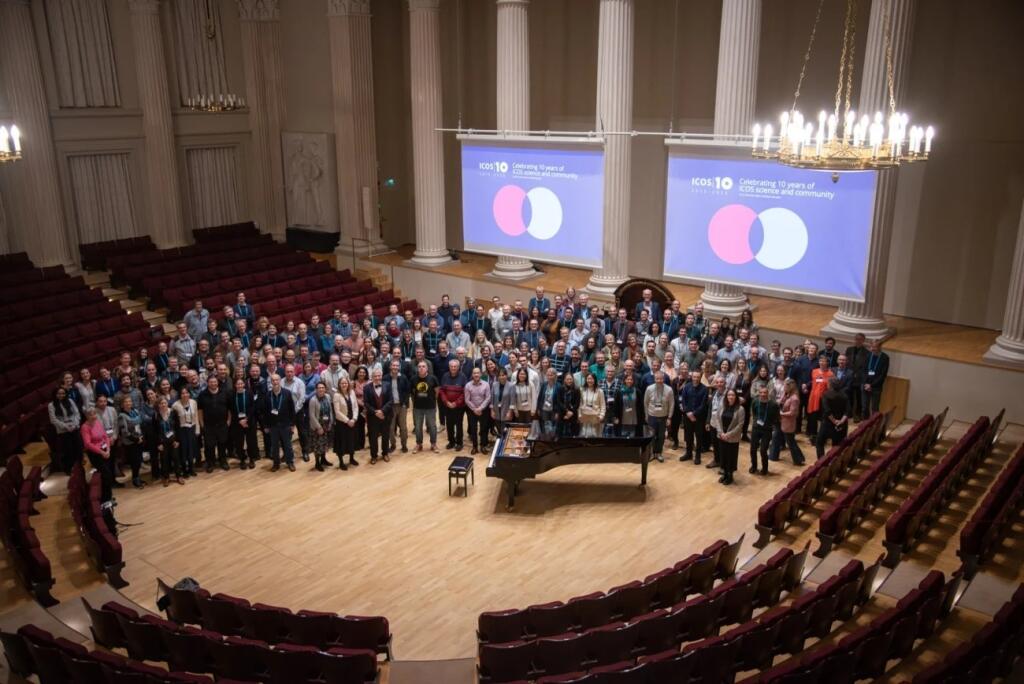
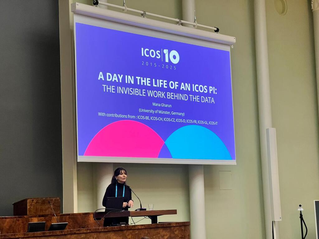
From the 25th to 27th of November Mana Gharun and Toprak Aslan joined the 10-year ICOS anniversary in Helsinki.
Mana gave a talk about the life as a PI and a scientific talk entitled "CDR and emission reductions, what can the ICOS community do?".
Next to scientists from various different counties this meeting brought together technicians, funders and collaborators. Click here, if you want to read more.
As part of large team Mana published a paper about the importance of forests in the journal Frontiers for Young Minds. They explain to a young audience the recipe you need for a forest and how scientists monitor the forest’s health. Did you know the difference between a pest or a disease affecting a tree?
Click here if you want to learn more about tree and plant health, biodiversity, forest growth and environmental stress and how you can help the forest. This work was peer-reviewed by young minds.
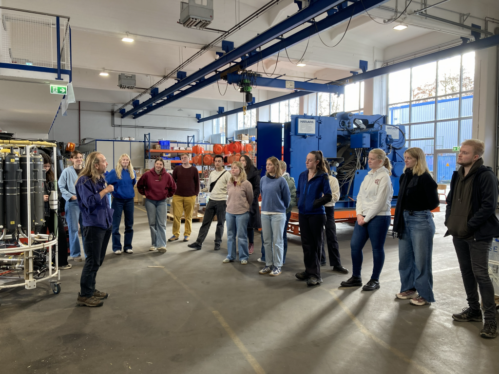
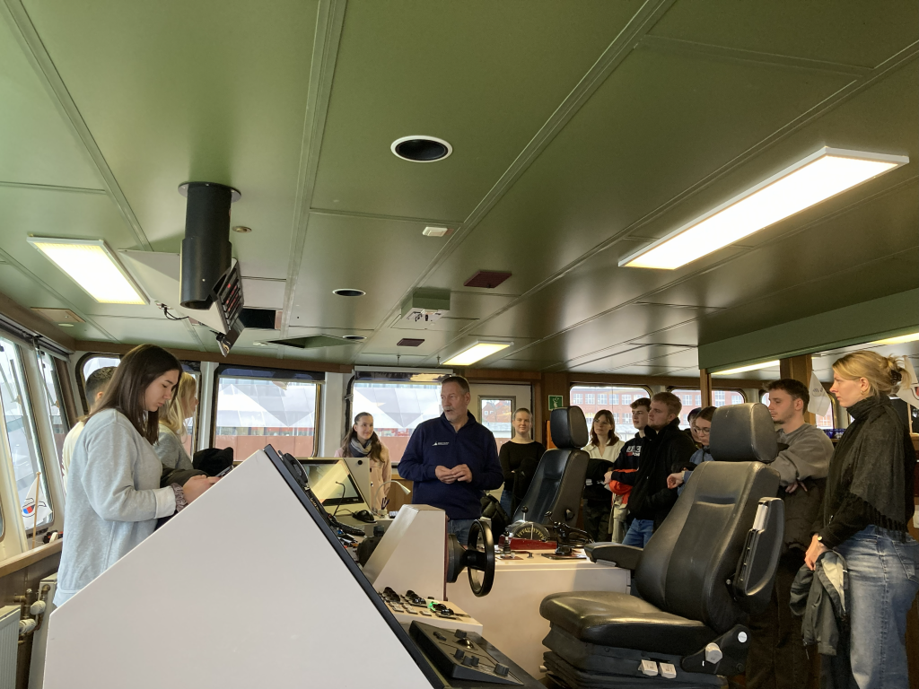
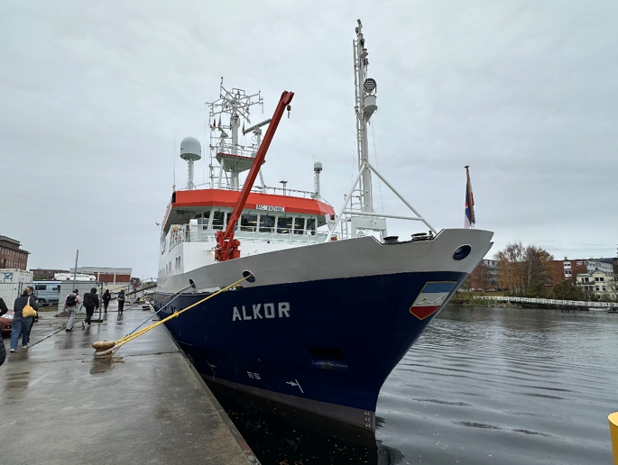
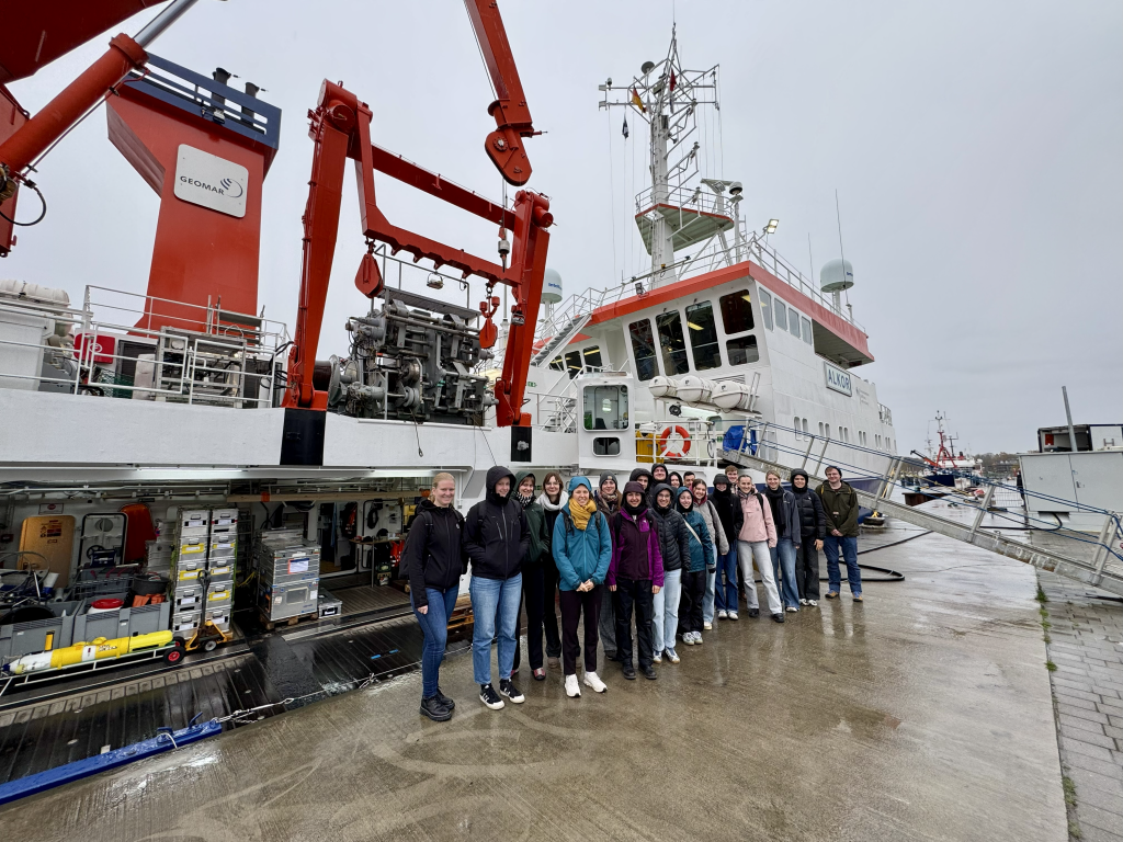
With 20 students from the bachelor's and master's programs in landscape ecology, geography, and water sciences, we spent three days following on the topic of ocean observations.
We visited the German Climate Computing Center(DKRZ) in Hamburg and the Geomar Technical Center in Kiel, where we gained many exciting insights into climate modeling and seagoing oceanography.
The excursion was rounded off with a walk on the beach with the Kieler Meeresfarm and a visit to the research vessel Alkor.
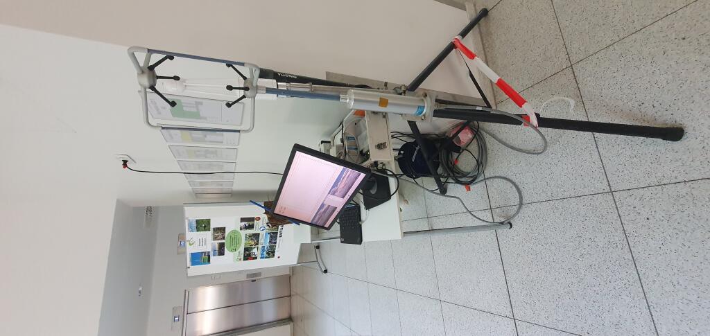
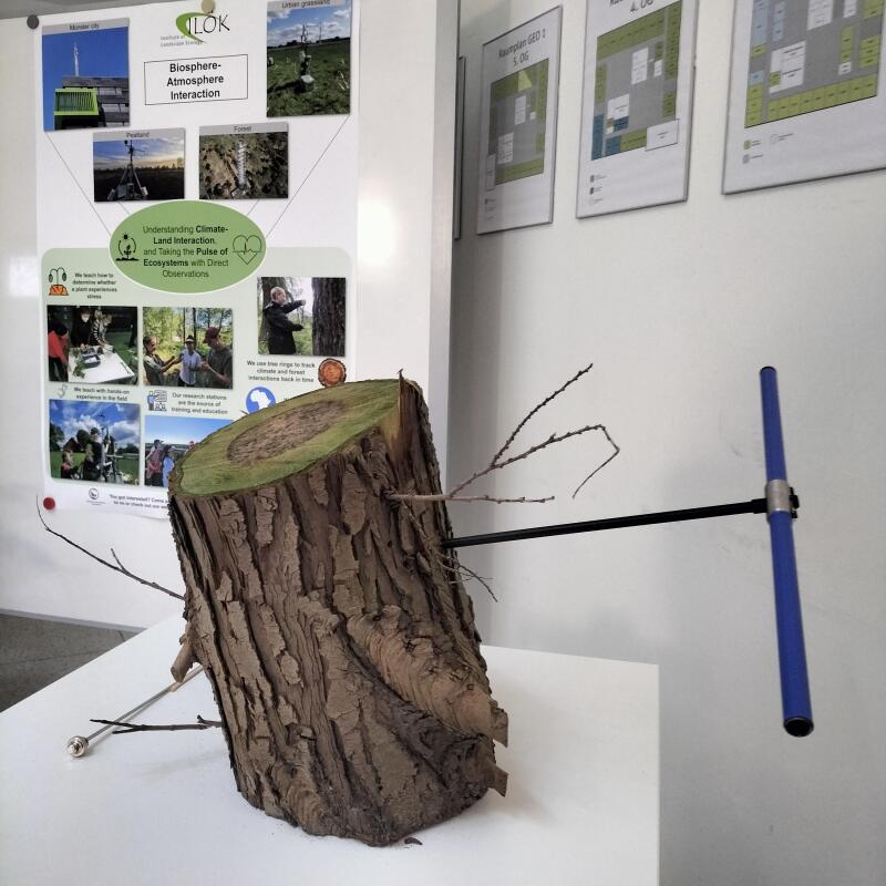
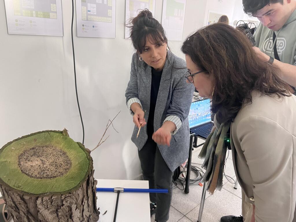
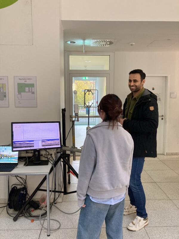
We presented our working group at this year's Geo.Science.Day. In addition to a poster displaying our teaching offerings, our postdoc Dr. Toprak Aslan set up a small eddy covariance tower where visitors could observe fluctuations in the CO2 content of the air.
Visitors were able to extract tree cores from a tree trunk using a drill. This method is part of dendrochronology, which can be used to determine the age of trees, among other things, but also to make statements about past climatic conditions.
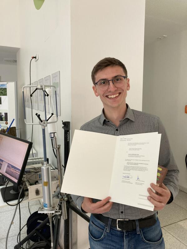
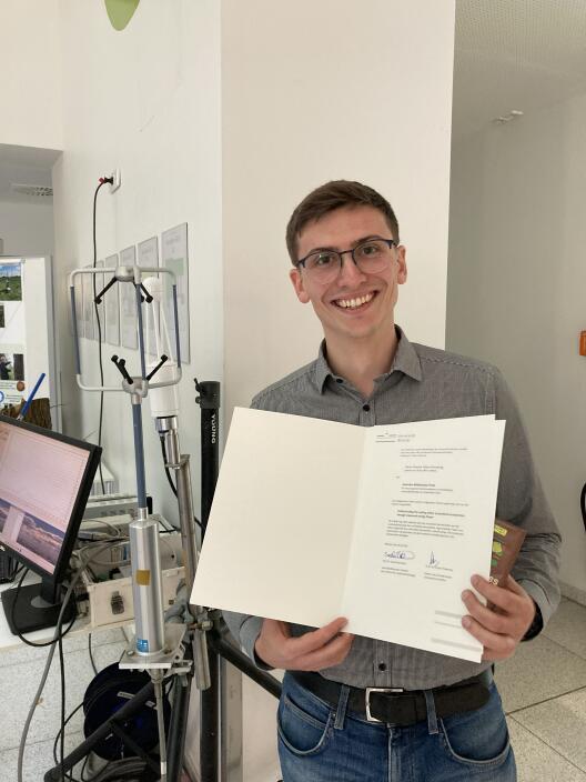
As a highlight, our master's student Vincent Flemming was honoured with the Jeannine-Böhmichen-Prize.
Vincent Flemming receives the Jeannine-Böhmichen Prize for his outstanding Bachelor thesis with the title “Understanding the cooling effect of peatland ecosystems through measured energy fluxes”. Vincent investigated the cooling effect of peatland ecosystems using data from an eddy covariance tower from the Amtsvenn-Hündfelder peatland. Vincent says: “If our atmosphere gets warmer and drier due to climate change, the Amtsvenn-Hündfelder peatland is likely able to stabilize the microclimate through increased transpiration. […] These findings are important for planning and selection of vegetation management measures in peatland ecosystems.”
If you want to know more, you can find the thesis here. Currently Vincent is working on getting this manuscript published.
Congratulations, Vincent!
News article on climate research in Lüntener Forest
With a new, approximately 30-meter-high measuring tower, the Biosphere-Atmosphere Interaction Research Group is collecting valuable data in the Lünten Forest, near the Dutch border. During the rewetting of the former moor and heathland area, greenhouse gas fluxes are to be measured precisely in order to better understand interactions between the environment and climate and to implement climate protection measures effectively.
The university newspaper has dedicated a detailed report to this exciting and ambitious project, which can be read here. There is also a short YouTube video here.
New paper: 26 years of continuous CO2 flux measurements now published in Global Change Biology
As part of her PhD research, Luana published an analysis of 26 years of continuous CO₂ flux measurements from a spruce forest in Davos, Switzerland. Using explainable AI, she disentangled the effects of phenology and abiotic drivers on long-term changes in forest CO₂ fluxes. Read the full paper here.
Vincent Flemming on his student job at the Biosphere-Atmosphere Interaction working group
As part of the university series ‘My student job at the university’, our MSc Landscape Ecology student Vincent Flemming was recently featured in the university newspaper wissen|leben (issue 3, May 2025). Since the end of 2023, Vincent has been supporting our group with great commitment - in the lab, at his desk and during exciting field work in the field. The article offers an authentic insight into his varied working day. Read the full article here.
MSc Landscape Ecology students learn about the Eddy Covariance technique
Students of the course Practical Biosphere-Atmosphere Exchang have successfully set up their own eddy covariance system and begun measuring CO2, water vapour and energy fluxes in an urban grassland site. The hands-on project offers them experience in micrometeorological methods and provides real-world insights into greenhouse gas observations. The initiative is part of our ongoing efforts to integrate field-based learning with scientific theory in geoscience education.
Biosphere-Atmosphere Interaction research group launches a globally unique greenhouse gas monitoring system
In collaboration with stakeholders from LWL and district of Borken, our group has successfully completed the installation of a 30-meter eddy covariance tower in the Lünten Forest. This project is globally unique, as it will monitor greenhouse gas fluxes before, during, and after the rewetting of the forest—part of a broader effort to restore its carbon storage capacity. By initiating measurements ahead of the rewetting process, we can precisely track how ecosystem greenhouse gas emissions respond to restoration, providing high-resolution data to evaluate the effectiveness of such climate mitigation measures.
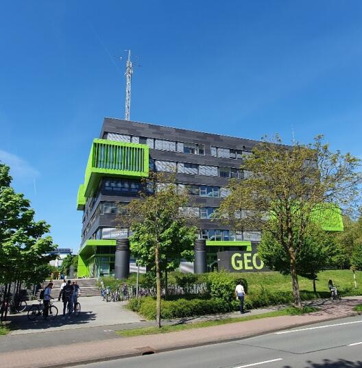
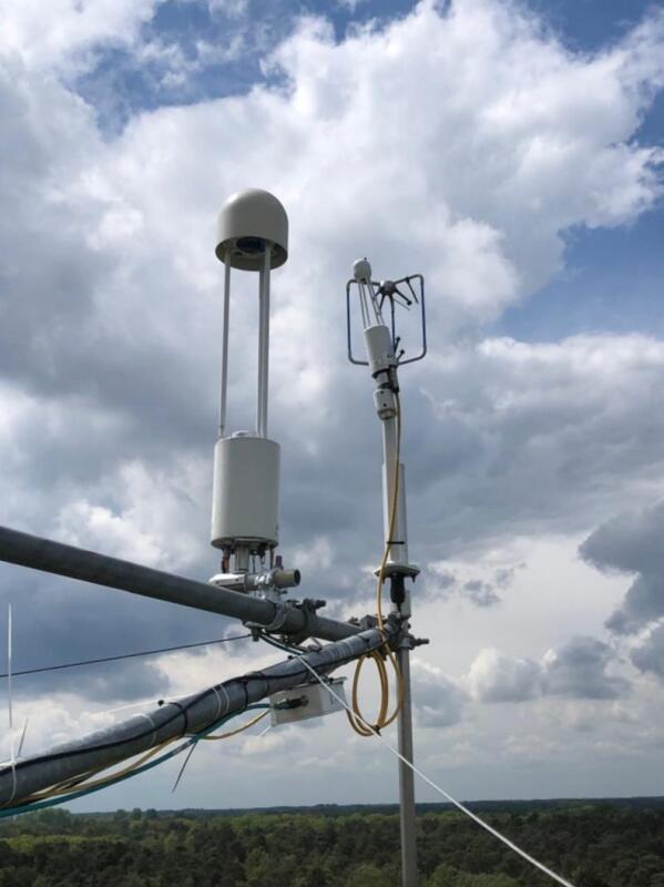
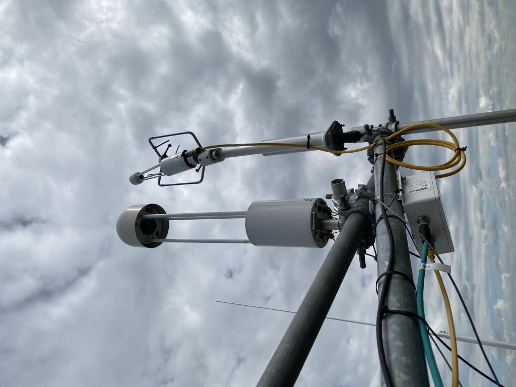
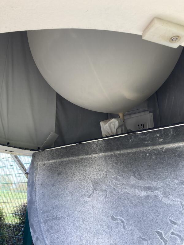
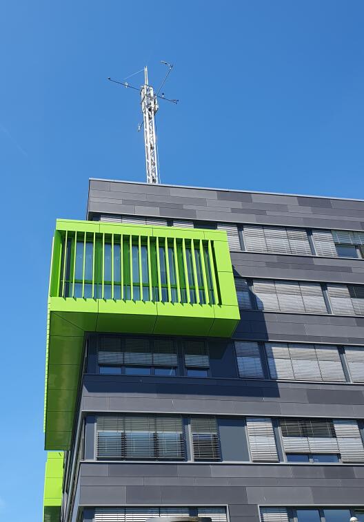
An eddy covariance system has been successfully installed on the rooftop of the GEO1 building. Over the next two years, researcher Dr Toprak Aslan will monitor greenhouse gas emissions from the city of Münster—Germany’s bicycle capital—to gain new insights into the dynamics of urban gas fluxes.
Urban climate research project selected as a lighthouse project
Our project "Münster Climate under Change" was selected as a lighthouse project by the Universitätsgesellschaft Münster. With this fund, our group will start measuring greenhouse gas fluxes of the city of Münster, directly from above the GEO1 building to support the city in achieving the net zero emissions goals based on high quality gas flux observations and monitoring.
More information can be found here [only available in German].
Warm Welcome to Toprak Aslan
Welcome to Toprak Aslan, our new postdoctoral researcher and Alexander von Humboldt Fellow! Toprak joins our group from the Finnish Meteorological Institute and will be focusing on urban greenhouse gas fluxes in the city of Münster over the next two years.
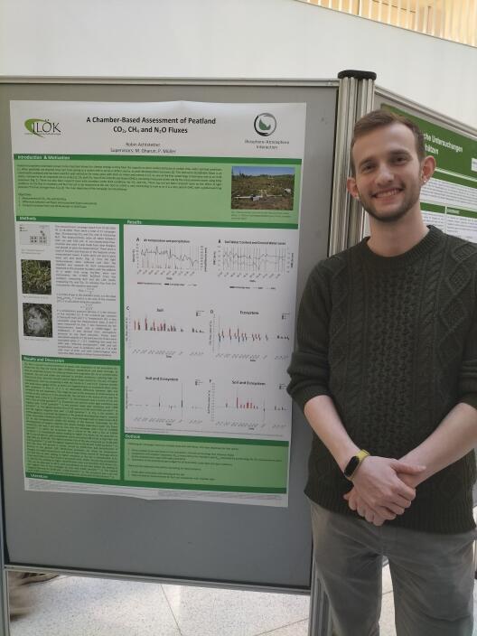
Presentation of chamber-based N2O, CH4, CO2 flux measurements in DE-Amv
At this year´s ILÖK Graduate Colloquium, our MSc Landscape Ecology student, Robin Achtstetter, presented the results of his greenhouse gas flux measurements of CO₂, CH₄, and N₂O, conducted within the footprint of our eddy covariance flux station DE-Amv.
Between July and November 2024, Robin carried out 17 measurement campaigns, giving us the first insights into the full greenhouse gas fluxes of the peatland ecosystem.
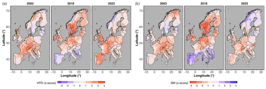
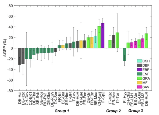
Our recent study shows that the 2022 summer drought significantly compromised the photosynthetic capacity of trees, leading to widespread declines in vegetation functioning across Europe, especially in deciduous broadleaf forests. Despite less severe overall conditions compared to previous extreme years, the greater canopy damage observed in 2022 suggests a growing vulnerability of forests to drought. Read the full article here.
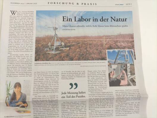
"A laboratory in nature" is the title of an article about our research station in the Amtsvenn-Hündfelder Moor, published in the newspaper of the University of Münster. Read the full article in both German and English here.
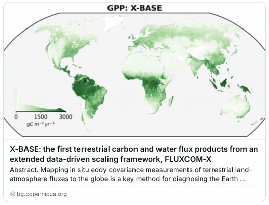
New Publication: X-BASE - the first terrestrial carbon and water flux products from an extended data-driven scaling framework, FLUXCOM-X
The latest global FLUXNET net ecosystem exchange of CO2, H2O, gross primary productivity, and evapotranspiration upscaling for 2001-2021 (daily 0.25 degree, monthly 0.05 deg) - Fluxcom-X paper led by Jacob Nelson (Max Planck Institute for Biogeochemistry, Jena) is now out in Biogeosciences. Read the full paper here.
The Institute of Landscape Ecology of the University of Münster is now officially part of the ICOS Research Infrastructure network. After a labelling process that started in January 2024, on November 6th our eddy covariance station in the Amtsvenn-Hündfelder Moor was officially assigned an ICOS label. Having this label guarantees the highest quality standards for greenhouse gas measurements, underscoring our commitment to excellence in climate research.
Our station in Amtsvenn is the only station across this European network that with already 2 full years of gas measurements before rewetting, will enable us to quantify greenhouse gases before, during and after rewetting measures.
At the ICOS Science Conference 2024 in Versailles France, Mana Gharun, Ana Bastos, and Thanos Gkritzalis organized and chaired a session about climate extremes and greenhouse gas fluxes. The session attracted many interesting contributions from all three domains of ecosystem, atmosphere, and oceans.
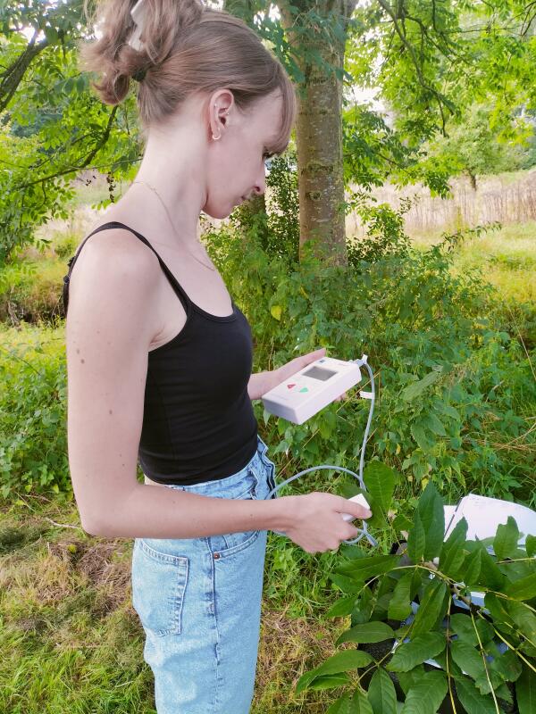
This summer semester, the Biosphere-Atmosphere Interaction group offered a new block course Advanced Methods in Applied Ecophysiology. In this course the students practiced designing an experiment in the field, collected measurements with hand-held devices, analyzed their data and presented their results. Plus they had fun working outside!
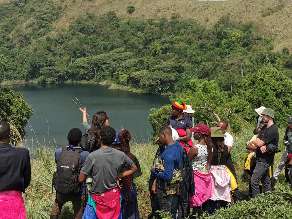
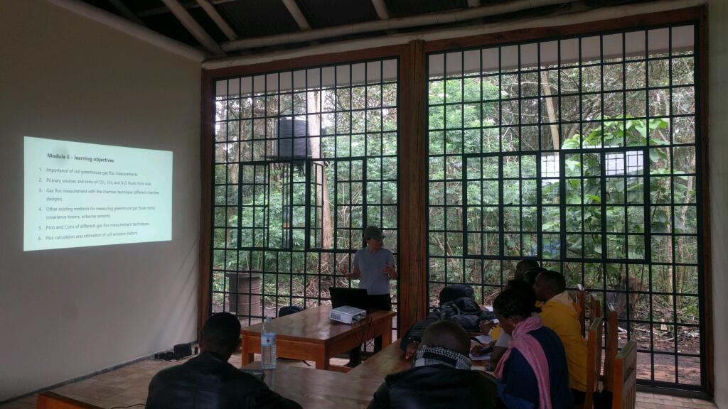
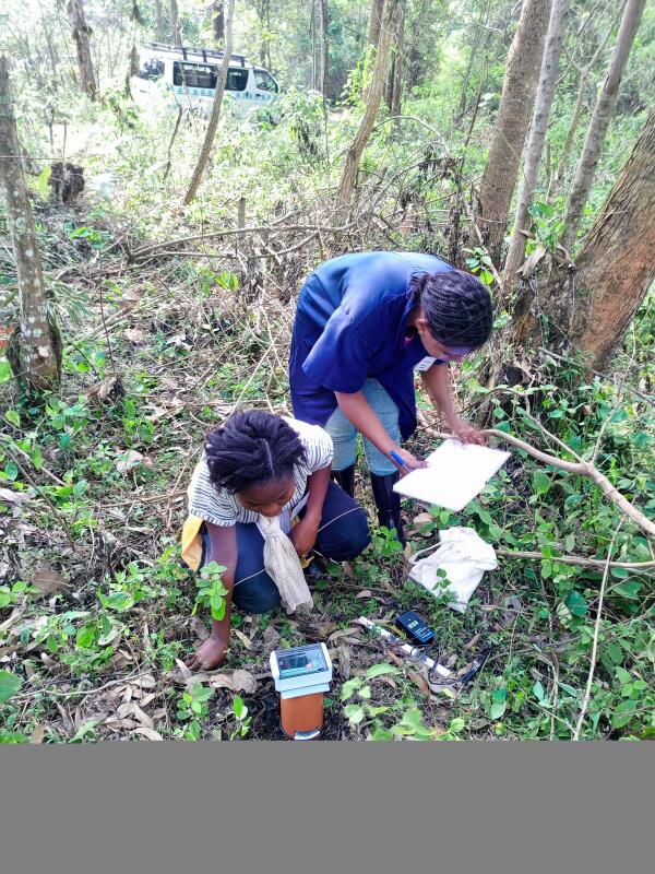
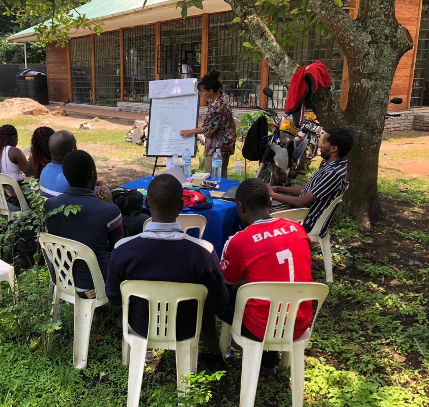
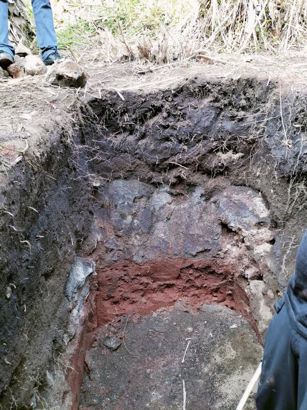
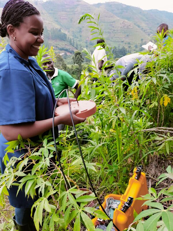
Professor Mana Gharun took part in the first Summer School on Assessment of Tropical Forest and Soil Resources
Professor Mana Gharun took part in the first Summer School on “Assessment of Tropical Forest and Soil Resources” in Fort Portal, Uganda. She taught participants about soil greenhouse gas fluxes and how to measure them with low-cost sensors. The event was a joint effort, organized with colleagues from ETH Zürich (Switzerland), Ghent University (Belgium), the University of Augsburg (Germany), the Kyaninga Forest Foundation (Uganda), and Mountains of the Moon University (Uganda).
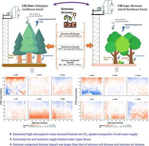
New Publication: CSAD events and CO2 fluxes of a mixed deciduous forest
With global warming, forests are increasingly exposed to “compound soil and atmospheric drought” (CSAD) events, characterized by low soil water content (SWC) and high vapour pressure deficit (VPD). Such CSAD events trigger responses in both ecosystem and forest-floor CO2 fluxes, which we know little about. In this study, the objectives were (1) to characterize CSAD events at CH-Lae, (2) to quantify the impact of CSAD events on ecosystem and forest-floor CO2 fluxes, and (3) to identify the major drivers and their temporal contributions to changing ecosystem and forest-floor CO2 fluxes during CSAD events and CSAD growing seasons. Read more here.
Our dataset is now published
ETH Zürich - Research Collection
Our dataset of leaf water potential measurements collected at the subalpine Norway spruce forest of Davos-Seehornwald from 2020 to 2022 is now published.
Measurements were collected as part of project FEVER.
Paper from Elisa Jordan's bachelor thesis published
published in Journal Atmosphere
Paper from the BSc thesis project of our student of landscape ecology Elisa Jordan is now published in Journal Atmosphere. Elisa researched the assessment of the volatility of the daily maximum temperature in Germany between 1990 and 2022. Read more here.
New paper from the MSc thesis of Capucine Marion
published in Tree Physiology
Paper from the MSc thesis project of former student at ETH Zürich and Eawag, Capucine Marion is now published in Tree Physiology. In this research Capucine developed a new method for in-situ measurement of dissolved gases in trees: Read more here
Prof Gharun awarded by the Alexander von Humboldt Foundation
Prof Gharun has been awarded by the Alexander von Humboldt foundation as the Henriette Herz scout. With this opportunity she can nominate 3 talented researchers from abroad to join the biosphere-atmosphere interaction group as a postdoc.
A warm welcome to our new PhD candidate Yu Luo who joined the Biosphere-Atmosphere Interaction group on 1 May. Yu will be working on the acclimation of global forest ecosystems to cascading drought and heatwave events.
Congratulations to PhD candidate Luana Krebs for the publication of her first paper in the journal of Biogeosciences! Luana looked into drivers and annual budgets of the forest-floor respiration, N2O fluxes, and CH4 fluxes in the subalpine forest Davos-Seehornwald in Switzerland. You can now read the full paper here.
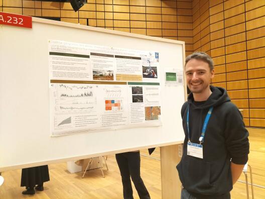
Nicolas Behrens presented results from project PEAT at EGU
Our PhD candidate Nicolas Behrens presented exciting results of his global peatland eddy covariance flux measurements at the EGU conference in Vienna, in a session about "Budgets, Trends, and Drivers of Major Greenhouse Gases from Regional to Global scales".
Elisa Jordan presented the results of her Bachelor thesis at EGU
Our BSc Landscape Ecology student Elisa Jordan presented the results of her Bachelor thesis entitled "Assessing extreme temperature volatilities across Germany between 1990 and 2022" at the EGU conference in Vienna, Austia. The presentation was marked as the "highlight" of a session on land-atmosphere interactions and climate extremes.
New paper from project FEVER
New paper from our project FEVER now published in the journal of Weather and Climate Extremes shows increasing air temperatures lead to drier air & soil, impacting ecosystems & climate modulation. We observed across Europe a 1.2x increase in extreme dryness from 1991-2021, with projections under RCP8.5 suggesting a 4.6x rise by late-21st century! Read the full paper here.
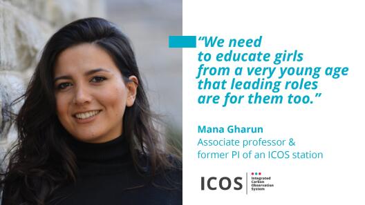
Happy International Women´s Day from the Biosphere-Atmosphere Interaction group! Read an interview of ICOS-RI with Mana Gharun, re-posted from last year:
New paper from our project FEVER, and led by Ankit Shekhar is now published in Science of the Total Environment. Using long-term ecosystem-level carbon and water flux measurements, and long-term tree-level dendrometer and sapflow measurements we show that in the context of drought response, it matters to assess soil or atmospheric drought, because forests respond differently to these or their compounds.
We have now added a CH4 analyzer to the eddy covariance system at our ICOS candidate flux station Amtsvenn-Hündfelder Moor. We are very happy to see the very first set of measurements! Thanks especially to the group of Prof Otto Klemm for lending us their methane analyzer!
At the 21st Swiss Geoscience Meeting this year Luana Krebs presented very nice results from the second study of her PhD thesis"25 years of net ecosystem CO2 exchange in a subalpine spruce forest". Great job Luana!
Today we close the first annual CO2 budget
Peatland eddy covariance station Amtsvenn
Today we close the first annual carbon budget for our recently established peatland eddy covariance station Amtsvenn (DE-Amv). The peatland has emitted 158 gC/m2 in one year (between October 2022 and October 2023).
Maintaining continuous high quality flux measurements are hard work but extremely necessary for determining the role ecosystems as carbon sinks or sources, and making informed decisions about land use, conservation, restoration, and climate change mitigation strategies.
Recent study published in Communications Earth & Environment
Co-optimization of CO2 uptake and albedo effects enhances impact of forests on cooling the climate. How? Find out in our recent study now published in Communications Earth & Environment.
Lockdown Reduced Air Pollution Across Europe
Spring 2020 lockdown due to COVID-19 pandemic led to reduced air pollution across Europe. In a recent study now published in the Science of Total Environment we explored how this reduced emission of pollutants affected radiation and consequently plant productivity across ecosystems in Europe.
Warm Welcome to Giorgos Xanthopoulos
A warm welcome to Giorgos Xanthopoulos, PhD candidate from Democritus University of Thrace , who is visiting our group on a Short-Term Scientific Mission (STSM) within CLEANFOREST Cost Action project. The PhD project of Giorgos is about measuring and understanding carbon and water dynamics of natural Aleppo pine ecosystems.
"How is climate change affecting the ecosystem functioning and biosphere-atmopshere interaction processes in mountain ecosystems?" This was the topic of a 5-day excursion to the Swiss Alps (24-28 July 2023), offered for the first time by the Biosphere-Atmosphere Interaction group. During this excursion students hiked up to forest and grassland ecosystems along elevation gradients, visited long-term monitoring sites and transplant experiments, and collected their own measurements.
Eddy Covariance Station will join the Network of ICOS RI
We are happy to announce that our newly established eddy covariance station in Amstvenn-Hündfelder Moor will join the network of ICOS RI, the steering committee of ICOS Germany has informed us! ICOS RI is the Integrated Carbon Observation Network Research Infrastructure that generates standardized, high-precision, long-term observations of the carbon cycle with the aim to reduce uncertainties in corresponding model predictions, to warn of negative developments at an early stage and to initiate adaptation measures in time, and to evaluate the success of climate protection measures.
The labelling process for Amtsvenn will start in January 2024!
New Paper
by Ankit Shekhar
Increased intensity and frequency of atmospheric dryness is not changing the resistance of forests to drought in terms of net ecosystem productivity! Read our latest paper led by PhD student Ankit Shekhar published now in Global Change Biology.
Congratuations to Ankit Shekhar for successfully defending his doctoral thesis on forest vulnerability to extreme dryness. Visit Ankit´s list of publications to find out more what he has been working on during his PhD.
First Annual Meeting of the COST Action Project CLEANFOREST
The first annual meeting of the COST Action project CLEANFOREST took place in Thessaloniki, Greece, with +80 particiapnts. The BAI group is co-leading the third working group on interactions between global change drivers and tree and soil biogeochemical processes and is looking forwared to fruitful collaborations over the next coming years!
This year at EGU2023 in Vienna, Nicolas Behrens presented what he has been working on over the past 8 months of his PhD project and had fruitful discussions. The title of Nicolas´ presentation was: Disentangling biotic and abiotic drivers of CO2 flux in a drained German peatland using eddy covariance flux measurements and modelling techniques.
Workshop on "Ecosystem-Atmosphere Interactions and Nature-Based Climate Solutions"
The 2-days workshop on "Ecosystem-Atmosphere Interactions and Nature-Based Climate Solutions" organized by the Eco-Meteorology group at the Max Planck Institute for Biogeochemistry in Jena was an exciting opportunity to present our research and discuss scientific ideas and developments across a range of ecosystem types relevant for mitigating climate change.
Session at EGU2023 in Vienna
Happy to announce that this year (also) we will have a session focused on “Novel methods for bridging process-based and data-driven modelling of carbon, energy, and water fluxes from leaf to continental scales” at EGU2023 in Vienna, Austria.
This session will take place on 27-28 April, with many exciting presentations and a keynote by Prof. Dr. Christiane Werner from the University of Freiburg.
New Publication
Surfaces soil of 48% of global vegetated area has dried over the past 40 years! Find out more in our recent study now published in Science of the Total Environment.
The Biosphere-Atmosphere Interaction group welcomes Visweshwar Arulmozhi Nambi who will be working on his MSc thesis project "Assessment of structural and topographic influences on greenhouse gas flux observations using a footprint model and LIDAR measurements in a peatland ecosystem". The project is an exciting collaboration between Institute of Landscape Ecology and Institute for Geoinformatics.
New Publication
Wondering how well do solar-induced fluorescence (SIF) products explain global terrestrial gross primary productivity (GPP)? Find out in our latest study published now in the Remote Sensing of Environment journal.
Eddy Covariance Flux Tower installed
The first eddy covariance flux tower of the group of Biosphere-Atmosphere Interaction was successfully installed in the Amtsvenn-Hündfelder Moor in September. We are looking forward to collecting exciting greenhouse gas flux measurements from this relevant ecosystem, educating students, and extending our collaborations with the national and international community!
Congratualtions to Nicolas Behrens for officially starting his PhD at the BAI research group. Over the next 3 years Nicolas will be working on measuring and understanding greenhouse gas emissions from peatlands. Welcome Nicolas!
New Publication
How do forests modulate soil water storage during severe drought? Read our recent study led by Katrin Meusburger at WSL now published in Global Change Biology!
It was great being back at EGU and this time in person! We had a great session thanks to our fantastic speakers and a great audience. Looking forward to continuing our discussions on challenges that scaling carbon and water fluxes entail.
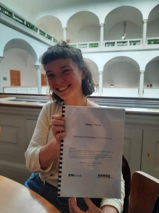
Congratulations to my M.Sc. student Capucine Marion for successfuly submitting her thesis on "Measuring Dissolved Gases in Tree Xylem Sap" at ETH Zürich. Capucine will be presenting results of her M.Sc. research project at the next Goldschmidt 2022 Conference in Hawaiʻi, USA. Well done Capucine!
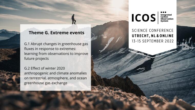
The 5th ICOS Science Conference
The 5th ICOS Science Conference takes place in Utrecht Netherlands 13-15 September 2022 The overarching theme of the conference is "Tracking progress to carbon neutrality”. If you are interested in climate extremes and greenhouse gas emissions the Biosphere-Atmosphere Interaction group invites you to submit your abstract to our session G.2. Abstract submission deadline is 11 April 2022 at 11.00 am CET.
Field visit to Amtsvenn peatland to evaluate the site for setting up a new eddy covariance measurement station. Our plan is to quantify emissions and uptake of greenhouse gases in a system-based approach and in collaboration with several other working groups within ILÖK as part of an interdisciplinary research project.