
Rapid climate change and biodiversity loss pose major challenges and lead to far-reaching ecological changes. However, measurements and observations from climate stations, soil samples, vegetation surveys, animal trapping, and gas flux measurements typically only provide spatially limited and not always temporally continuous data. One of our core research focuses is therefore the large-scale monitoring of the environment and its changes. We combine ecological field observations with remote sensing data to enable spatially comprehensive and continuous environmental monitoring, detect changes, and gain deeper insights into the underlying dynamics.
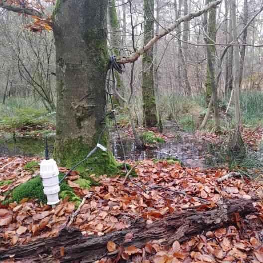
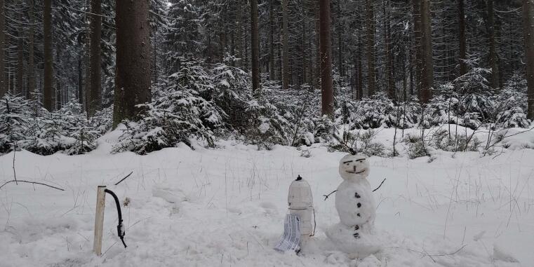
We work with sensors across various spatial scales – both with ground-based measurement systems, such as in the Lüntener Forest (Sensorlök project), where we monitor rewetting through a sensor network, and in the Natur 4.0 project, which focuses on nature conservation monitoring using networked sensor systems as a foundation for the protection of species and ecosystem functions. Local measurements and ecological observations primarily serve as reference data, as our goal is to enable large-scale environmental monitoring through integration with remote sensing data.
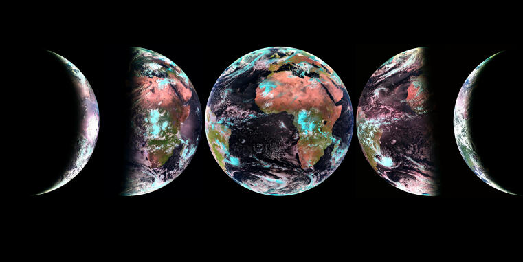
For the remote sensing based monitoring of the environment, we use high-resolution data collected by drones (see research focus on drone-based remote sensing) as well as satellite data, which, thanks to their regular acquisition, allow for continuous and large-scale monitoring. We utilize both high-resolution satellites such as Sentinel-2 and geostationary satellites like Meteosat. The latter are particularly useful for observing rapidly changing environmental variables, such as precipitation patterns (Meyer et al., 2016b), and provide valuable data for analyzing dynamic processes.
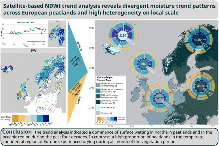
On the one hand, we work on the development of Earth observation products, such as the bush encroachment map of South Africa (Ludwig et al., 2019) or large-scale surface air temperature datasets for Antarctica (Nielsen et al., 2023; Meyer et al., 2016). On the other hand, we also focus on the further analysis of these products. A good example is the monitoring of moisture changes in peatland ecosystems (Giese et al., 2025). In this study, we analyzed changes across all European peatlands since the 1980s – made possible through the use of long-term satellite time series, particularly from the Landsat mission.
A key challenge, however, often lies in “translating” remote sensing data into meaningful environmental information to make changes visible and measurable. This complexity frequently requires the use of artificial intelligence (AI) methods. Since there is still significant need for development in the field of spatial environmental monitoring, this research focus is closely linked to our research focus on method development. Here, our self-developed approaches are directly applied in our research. Our goal is not only to detect environmental changes but also to gain a deeper understanding of the underlying processes and relationships. Methods of explainable artificial intelligence (Explainable AI), as presented in Baumberger et al. (2024), play a central role in this context.
We collaborate both with other research groups at ILÖK and with external partners, focusing on monitoring various environmental parameters across different ecosystems. Our work contributes to research in the following landscape ecology disciplines:
Soil Ecology: Modeling soil properties, such as soil moisture, temperature and respiration across space, time, and depth, e.g., Baumberger et al., 2024; Baumberger et al., 2025.
Vegetation Ecology: Assessing plant diversity, e.g., in grasslands, and studying vegetation dynamics in savanna ecosystems, e.g., Ludwig et al., 2019.
Animal Ecology: Modeling potential animal habitats, e.g., Krämer et al., 2025.
Hydrology: Monitoring peatland changes and evaluating the success of peatland restoration efforts, e.g., Giese et al., 2025.
Climatology: As international partners of the Antarctic Science Platform, we contribute to the analysis of spatio-temporal temperature patterns, e.g., Lezama Valdes et al., 2021; Nielsen et al., 2023; Meyer et al., 2016.
Quantifying and modelling peat breathing with satellite radar data (2023 – 2027)
Internally at the University of Münster Funded Project: Uni Münster-internal funding - Collaboration Grant for Young Researchers
BEyond – SPP 1374 - Subproject: Learning from the Exploratories to make prediction beyond them: AI-based mapping and explanation of grassland biodiversity and ecosystem functions for entire landscape units (2023 – 2026)
Subproject in DFG-Joint Project Hosted outside the University of Münster: DFG - Priority Programme | Project Number: HO 3830/13-1; ME 5512/4-1
ReVersal – ERA-Net Cofund BiodivRestore (Joint Call 2020-2021): Restoring peatlands of the nemoral zone under conditions of varying water supply and quality (2022 – 2025)
EU-Project Hosted outside the University of Münster: DFG - BiodivERsA (ERA-Net Cofunds) | Project Number: KN 929/26-1; ME 5512/3-1
Carbon4D – Carbon4D: A landscape-scale model of soil organic carbon mineralization in space, depth, and time (2021 – 2024)
Individual Granted Project: DFG - Individual Grants Programme | Project Number: ME 5512/2-1