
Drones enable the recording of large-scale environmental data with high spatial resolution and a temporal felixbility that can be adapted to a specific scientific question. Drone remote sensing has thus become an important tool in landscape ecology for obtaining spatial information on ecosystems and recording spatio-temporal processes, which opens up new possibilities in our research focus Environmental Monitoring. The constant technical progress of drone systems and sensor technology for data acquisition leads to new ideas and potential applications in landscape ecology which are developed and evaluated in our working group. In addition, there are still challenges in drone remote sensing with regard to data quality and the reproducibility of image processing (Ludwig et al. 2020) as well as data storage, for which we develop solutions in the working group and thus contribute to their establishment in environmental sciences and practice.
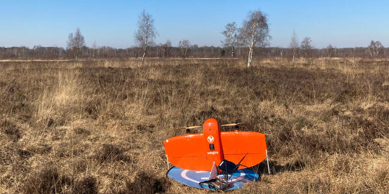
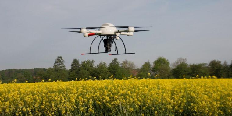
In our working group, we have access to different drones, sensors and processing tools that we can adapt to the specific study area and research question. We use the WingtraOne fixed-wing drone to record multispectral images, which are primarily used to record vegetation characteristics. Using the DJI M300 with LiDAR sensor, we are able to record 3D information in order to create detailed terrain models and vegetation structures. In addition, we are also investigating the possible applications of other sensors, e.g. hyperspectral spectroscopy and UV or thermal cameras, to derive soil moisture in peatlands or to estimate flower diversity in meadows.
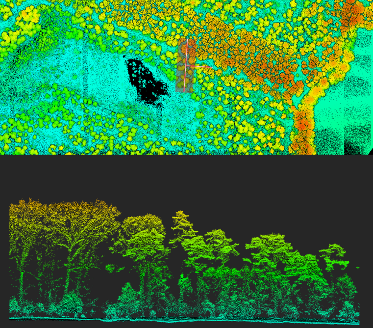
In our PC lab, we use powerful computers to process the drone images into orthomosaics and derive 3D information from LiDAR data. Following on from our research focus New Methods for Spatial Modeling, we also develop and use AI-based image recognition methods on the high-resolution images for segmentation and object recognition.
In our research, we use drone imagery to set field data in the landscape context in order to determine, for example, the water-holding capacity of vegetation not only at specific points, but over a wide area (Lehmann et al. 2022). Practical nature conservation also benefits from further development of drone remote sensing and we work together with partners from environmental offices, national parks and authorities to improve existing work processes, such as the mapping of flora-fauna habitats using drone remote sensing.
Ready for Take-Off!? - Integration der drohnengestützten Fernerkundung in das Monitoring von Offenland-FHH-Lebensraumtypen (2025 – 2028)
Gefördertes Einzelprojekt: Deutsche Bundesstiftung Umwelt | Förderkennzeichen: 38652/01 - 34/0