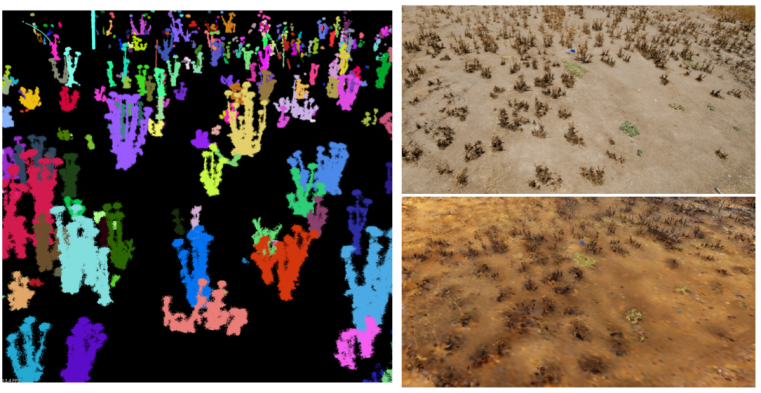
Reconstruction of Natural Habitats
The introduction of 3D scanning has strongly influenced environmental sciences. If the resulting point clouds can be transformed into polygon meshes, a vast range of visualisation and analysis tools can be applied. But extracting accurate meshes from large point clouds gathered in natural environments is not trivial, requiring a suite of customisable processing steps. We have implemented Habitat3D, an open source software tool to generate photorealistic meshes from registered point clouds of natural outdoor scenes. Habitat3D offers a variety of different filtering, clustering, segmentation and meshing routines. All routines can be arbitrarily assembled to pre-defined pipelines operating on either subsets (i.e. clusters) or complete clouds.