


This research project (duration: June 1, 2025–May 31, 2026), made possible by funding from the Friedrich Christian Lesser Foundation, aims to systematically record the complex phenomenon of imperial cities in the Middle Ages and the Early Modern Period and make it publicly and academically accessible through an innovative digital information system.
Initial Situation
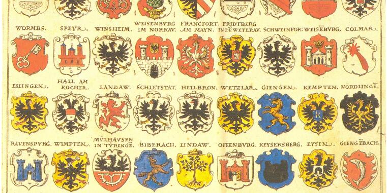
The term "imperial city" has been used inconsistently throughout history; attributions changed over time, and the boundaries between the group of free cities and autonomous urban communities often became blurred. Sources such as imperial registers or tax lists are incomplete or contradictory. A systematic, comparative overview that does justice to the diverse manifestations of the "Imperial City" type and provides both the temporal and spatial location of the Imperial Cities does not yet exist.
Project Objectives
The project creates a freely accessible internet portal with an interactive digital map offering the following core functions:
The information system pursues three main objectives: First, to create a low-threshold, didactically well-prepared offering for schools, educational institutions, and interested laypeople. Second, the data-driven and interactive visualization enables new scholarly perspectives on the imperial cities as a complex historical phenomenon. Third, the structured publication of the underlying research data according to modern standards (FAIR principles) creates a sustainable foundation for further research. The project thus combines sound historical research with modern methods of digital history and cartography – and makes a central theme of German and European urban history accessible in a new way.
Project Management Dr. Angelika Lampen
Project Staff Dr. Daniel Stracke, Stefan Tönnessen
Cartography Oliver Rathmann