European Historic Towns Atlases
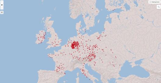
The European Historic Towns Atlases are a multi-national endeavour for research into the origins and development of European urbanism under the auspices of the “Atlas Working Group” of the International Commission for the History of Towns. In the form of printed atlases, important basic material is being provided in 19 national projects as sources to interdisciplinary research.
Next to the national project “Deutscher Historischer Städteatlas”, in Germany there are currently three active regional historic towns atlases, the “Rheinischer Städteatlas” (Rhineland), the “Hessischer Städteatlas” (Hessia), the “Historischer Atlas westfälischer Städte” (Westphalia).
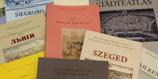
The aim of the historic towns atlases is the edition of cartographic and iconographic sources for the reconstruction of the historical topography of pre-modern urban spaces. At the centre is the ‘core map’, a large-scale plot plan based for the most part on 19th century cadastral maps, but there are older maps and plans as well as historic town views and other images. These sources are being processed and edited in the projects following common guidelines to ensure comparability and facilitate analysis on a European scale.
URL for citation
https://www.uni-muenster.de/Staedtegeschichte/en/portal/staedteatlanten