
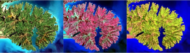
The acquisition of spatially continuous data and spatial-temporal dynamics from remote sensing information is a research focus of environmental sciences. To achieve this goal, modelling methods are required that allow the derivation of spatio-temporal information from limited field data. The complexity of environmental systems requires the use of modelling strategies, which allow to consider complex relationships between a multitude of variables.
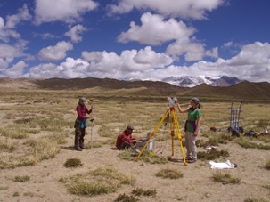
In this context, the research focus of the working group is the acquisition of spatio-temporal dynamics of environmental variables and processes from remote sensing data and using current machine learning methods. Thus, the working group is at the interface between geoinformatics and landscape ecology and aims to contribute to an increase in knowledge in ecosystem research through satellite data processing, modelling and simulations. In this context, we deal with a broad spectrum of environmental topics, in particular related to ecology, climatology and soil science, and across a broad spectrum of temporal, spatial and spectral scales.
The further development of machine learning methods in remote sensing also plays a decisive role. Although these methods have been used for a long time, the characteristics of geographical data are hardly taken into account in the machine learning strategies. In particular, spatial autocorrelation requires the development of new strategies to generate reliable environmental data sets from remote sensing information. Therefore, in addition to the application of remote sensing data for the acquisition of ecologically relevant parameters, we also work on methodological developments of functionalities, in particular for the application of machine learning methods for spatial data, both on the conceptual level and as software implementations, especially in R.