Atlantensammlung
in der Kartensammlung der Lehreinheit 1 - Geowissenschaften
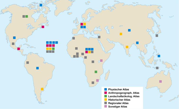
Welt
Detailkarten:
Europa/Deutschland
(Bitte fahren Sie zur
Anzeige des Atlas-Titels über die Signaturen)
Ice
Atlas of Arctic Canada, 1960
Atlas
of Canadian Agriculture
The
National Atlas of Canada
Nova
Scotia Development Atlas
Climatic
Atlas of North and Central America
Atlas
Geografico de la Republica Mexicana, 1919-1921
Zentralamerika-Karten
zur Bevölkerungs- u. Wirtschaftsstruktur
In
den Hoch-Anden von Ecuador (Bildatlas, H. Meyer)
Climatic
Atlas of South America
Atlas
Geografia Historia de la Pampa Anterior
Atlas
of Australian Resources
Atlas
Kalimantan Timur, 1982
Studies
in the Climatology of South Asia
Regional
Structure of Japanese Archipelago
Geological
Atlas of the Eastern Asia
Climatic
Atlas of Asia
Historisch-geogr.
Kartenwerk Indien
Karten
zu Merzbachers Reisen - Mittleres u. östl. Tian-Schan, 1928
Atlas
of Jerusalem, 1973
Atlas
du Maroc, 1958
Atlas
of Land Systems in Swaziland
Southern
Africa
The
Republic of Zambia, Vegetation Map
A
Land System Atlas of Western Kenia
Atlas
General du Congo
Afrika-Atlas
West
African International Atlas
Atlas
du Cameroun
Nigeria
Atlas
de Cote d'Ivoire
Ghana
Maps
Ghana
National Atlas, 1972
Lautensach:
Kolonialatlas
Development
Atals South-Africa
The
Climate of Africa
Climatological
Atlas of Africa
Niederschlag,
Temperatur und Schwüle in Afrika
Forschungen
zum ethnologischen Atlas Europas und seiner Nachbarländer
Atlas
des Colonies Francaise 1934
Atlas
of Subsurface Temperatures in the European Community
Soil
Map of the European Communities
IRO
Weltwirtschaftsatlas
World
Atlas of Agriculture
Wirtschaftsgeographischer
Atlas der Welt
Atlas
zu Ritter´s Erdkunde
Mercator-Hondius-Janssonius
Atlas 1636
IRO
Landkarte
Stieler
Handatlas
Atlas
international Larousse
Klimadiagramm-Weltatlas
A
quasi-global Presentation of Tiros III Radiation Data
Soil
map of the World
Morphologische
Drucke der Karten aus dem Bertelsmann Hausatlas
Weltforstatlas
Listenübersicht
aller Atlanten (regional geordnet)