Strengthening spatial orientation
Turn right in 100 metres. Stay in the left-hand lane. Turn right at the third exit. Such instructions are familiar enough to motorists, who have almost blind faith in their navigation system when they are driving on holiday, to business meetings or just in everyday life. The so-called “step-by-step” approach in providing instructions is the dominant one in satnavs and apps. For the geoinformatics specialists at the University of Münster, this approach is highly problematic as it does not enable users to develop any spatial understanding of their environment. “Most systems make minimum demands on motorists to get them to their destination. Hardly anyone relies on their own sense of direction anymore,” explains Prof. Angela Schwering, who has been studying navigation and spatial orientation since 2014 in the WayTO (Wayfinding Through Orientation) project, which is receiving funding from the European Union.
In the view of the Münster researchers, navigation guidance in the future should help users to take conscious note of their surroundings while driving and find orientation in certain structures and features. These so-called landmarks can be local – for example, the gas station on the corner – or provide more global orientation, such as the city centre bypassed on the left. “Spatial perception is both important and useful for people of all ages, enabling them to train and retain their cognitive skills,” says Schwering. It can be particularly important, she adds, when the user is required to be an active decision-maker – for example, when several things have to be done, such as doing the shopping, seeing the doctor and visiting friends. In such cases, the conventional left-right-straight-on scheme to get to a destination is not very helpful.
Anyone who blindly trusts what their navigation system tells them will, at some point, no longer know where they are at any particular moment and where and what they have driven past. “That is one of the core problems which we are examining in the project,” says cognitive scientist Dr. Jakub Krukar, a member of the project team. “People have several possibilities to orient themselves. They can make a note of the route they have travelled so far – and distinctive buildings such as a church or a hospital are local landmarks which can be linked to any directions given.” As a result, Krukar adds, a cognitive map is produced in the head which intensifies the general knowledge we have of our surroundings.
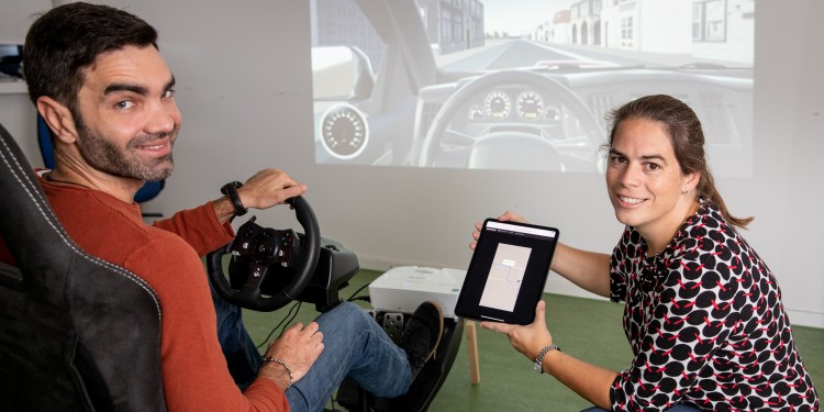
Over the past few years, the interdisciplinary team, consisting of geoinformatics and computer science specialists, cognitive scientists, psychologists and linguists, has, with the help of more than 1.000 test persons, carried out studies to ascertain which maps support spatial orientation. Using a driving simulator, the test persons drove through a virtual environment. Before this, the researchers changed the map on display: they highlighted relevant landmarks which were not only located directly on the route, but which also served as orientation on the global level, e.g. geographical features. In addition, the team simplified the route as displayed, just like bus or underground maps. For example, they reduced the number of roads and highlighted important decision points such as a church on the road the driver had to turn off. Also, they adapted the scales of routes by making motorway drives longer and crossroads smaller or more detailed.
The central result of this empirical study is that displaying local landmarks along the road increases knowledge of the route, while highlighting structural and global features supports the general overview and orientation. Based on these findings, the researchers are now producing demo maps with the new displays. “These maps offer enormous potential for older people, as well as for those suffering from dementia, as they train spatial orientation,” Angela Schwering explains. In addition to this, the researchers see a need for such maps especially in the tourist industry – for example, when discovering an unknown city. The simplified maps and the highlighting of landmarks help users to find their away around faster.
Angela Schwering’s team are currently working on a follow-up project application. Together with partners from the navigation industry, developers of geographical information systems, software companies and companies which design and manufacture maps, the aim is to investigate the potential of the new map displays. The first navigation manufacturers have already announced their interest in a collaboration.
This article first appeared in the University newspaper wissen|leben, No. 6, 14 October 2020.
