


Researching ecosystems from the air
It looks absolutely idyllic, watching the Heck cattle and Konik horses grazing in the meadows in the Emsaue wet meadows near the village of Vadrup. This pasture landscape, covering an area of 33 hectares and used all year round, lies in the Emsaue nature conservation area and was set up in 2004 as part of the implementation of the plan to protect the wet meadows by the River Ems. The area is around 15 kilometres north-east of Münster and is run by the NABU (Nature and Biodiversity Conservation Union) nature station for the Münsterland. Since 2016, landscape ecologists at the University of Münster have been taking a close look at the area in order to find about more about the flora and fauna there.
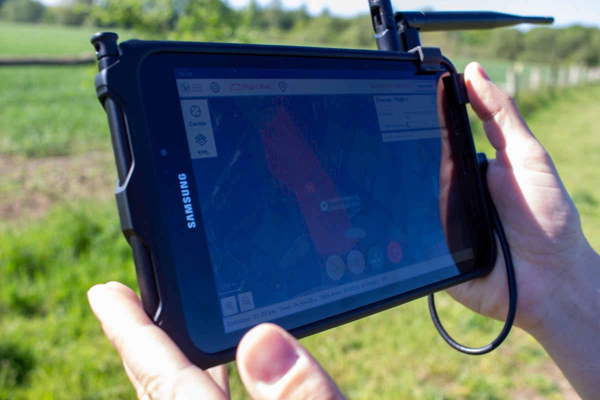
The researchers frequently make use of a drone weighing almost five kilos. These unmanned aerial vehicles (short UAV) produce ecosystem analyses from the air. Clara-Marie Putschky is evaluating the drone imagery for her bachelor thesis, investigating in the process the effects which so-called large herbivores – i.e. Heck cattle and Konik horses – have on the ecosystem in the Emsaue wet meadows. “What interests me most of all,” she says, “are mechanical disturbances to the ground which are caused for example by animals scraping with their hooves, and which are so important for insect populations.” Mapping the disturbances on foot would take a great deal of time. But with the aid of the high-res aerial images – which are computed from numerous orthogonal, overlapping individual images – these disturbances can be recorded automatically by means of specific classification algorithms.
Over ten years ago, a group of students led by Dr. Torsten Prinz from Münster University’s Institute of Geoinformatics began to construct their own multicopters. At that time there were only a few commercial drones for civil use. “We often used to meet in a University gym to try and get the drones to fly,” says Jan Lehmann, who was a keen builder of model aeroplanes as a child and later wrote his PhD dissertation on drone-based remote sensing in landscape ecology. “We were over the moon if the drone flew for five minutes – whereas today they can stay in the air for almost an hour and take in an area of up to 400 hectares,” he adds. Besides drone technology, at that time camera sensor technology wasn’t yet designed for ecological studies either. “Nowadays, drones are equipped with a professional multispectral camera which records the image data in high-res spatial form,” Lehmann explains. “The resolution spectrum ranges from individual plants to an entire landscape being examined.”
Whereas the focus used to be on tinkering with drones and screwing them together, today’s interdisciplinary Geo1Copter group is interested most of all in evaluating data. (Geo1 stands for the building housing the geoinformatics and landscape ecology specialists.) “For modern-day nature conservation, drones are a valuable tool,” explains Prof. Christoph Scherber, who heads the Animal Ecology and Multitrophic Interactions working group at the Institute of Landscape Ecology. “Drones have proven their worth as an inexpensive and comparatively easy-to-manage technology for studying habitats, animal populations and the development of ecosystems,” he says. Practical nature conservation benefits too: “The information and data which we obtain by using drones are very important when we plan nature conservation measures – especially when monitoring habitats or evaluating the potential for them,” says Dr. Christian Göcking from the NABU Münsterland nature station.
Before drones can be used in the Emsaue area, the researchers have to complete a fair amount of paperwork, because the flights over nature conservation areas are subject to strict conditions and have to be approved by the nature conservation authority. “The advantage which our drone has is that it flies almost without making any noise, which means that animals breeding on the area aren’t disturbed. And the drone takes off and lands outside the nature conservation area,” says Henning Schneidereit, a student assistant who is currently preparing to get his drone user’s certificate –because flying a drone requires an operating licence from the Federal Civil Aviation Office.
The Geo1Copter group is also active outside the Münsterland. For example, it has mapped the moor vegetation in the Tierra del Fuego National Park in Patagonia, at the southernmost tip of South America. In Brazil, the researchers have recorded the spread of invasive acacias in the hitherto little studied Mussununga ecosystem, as well as overflying inaccessible inselbergs. They want to use the images to compute the degree to which the steep walls are covered by the bromeliads growing there, which have a large influence on the landscape and the water balance.
In spite of all the technological progress and the reduction in the workload that this entails, some tasks still have to be carried out on foot and by hand. “In the summer I carry out insect quantification in the Emsaue area,” says Clara-Marie Putschky. “I count wild bees on some of the ground disturbances and in the areas fully covered in vegetation.” Afterwards, she extrapolates the results of her mapping work to take in the entire area.
In the future, the project group would like to purchase a hyperspectral camera for the drone. “They used to be as big as a microwave, but today you can get them as small as a mobile phone and they can gather very high-res data spectrally,” says Jan Lehmann. The group would also like to spend more time on monitoring peatlands. “These ecosystems are in particular danger, especially because of the increasingly dry summers and intensive agriculture – and this produces a lot of fascinating issues for research,” explains Christoph Scherber.
Author: Kathrin Kottke
This article was first published in the University newspaper wissen|leben No. 5, 15 July 2020.