Faulting and neotectonics
© All photographs on this webpage may be downloaded and used for teaching purposes only. The photographs may not be reproduced in any publications - commercial or scientific - without permission by Ralf Hetzel.


© All photographs on this webpage may be downloaded and used for teaching purposes only. The photographs may not be reproduced in any publications - commercial or scientific - without permission by Ralf Hetzel.
Download full size image (1,4 MB)
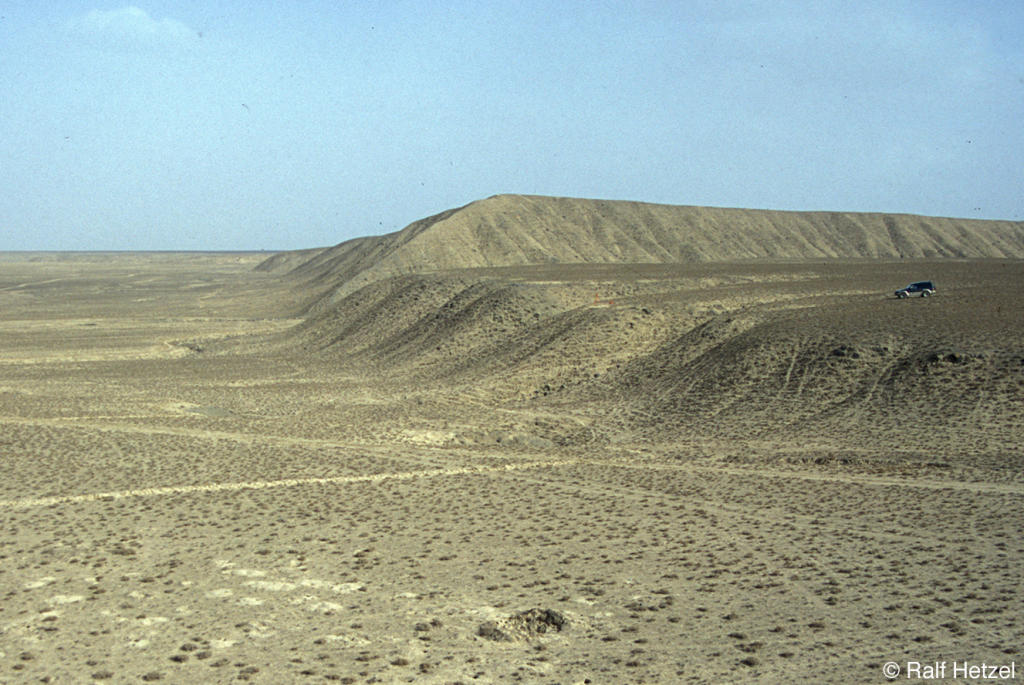
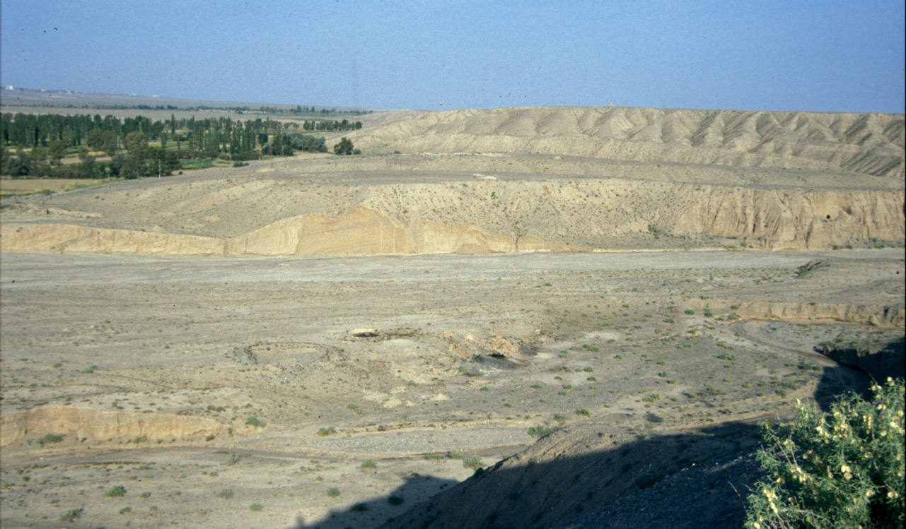
A thrust fault scarp at the NE margin of Tibet (Zhangye thrust, Qilian Shan). View is along strike of the scarp. In the foreground the fault offsets a river terrace and forms a 20-m-high scarp (car on terrace in the uplifted hanging wall provides scale). In the background the scarp offsets an older alluvial fan and reaches a height of more than 50 m. The steep slope extending from the center of the image to the right constitutes the boundary between the alluvial fan surface and the river terrace.
Related Publications:
Hetzel R., Tao M., Stokes S., Niedermann S., Ivy-Ochs S., Bo G., Strecker M.R., Kubik P.W. (2004). Late Pleistocene/Holocene slip rate of the Zhangye thrust (Qilian Shan, China) and implications for the active growth of the northeastern Tibetan Plateau, Tectonics 23 (6), TC6006, doi:10.1029/2004TC001653.
Download full size image (4,6 MB)
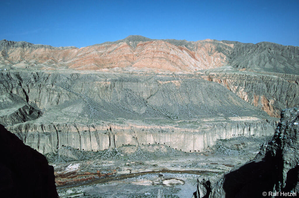
Active fold-propagation fold developed in Neogene red beds at the margin of NE Tibet (Qilian Shan). Two fill-cut terraces, which are partially covered by a thin loess blanket and alluvial fans, are located ~40 m and ~100 m above the river. Surface exposure dating using the cosmogenic nuclide 10Be demonstrates that river incision and terrace formation is largely climate-controlled.
Related Publications:
Hetzel R., Niedermann S., Tao M., Kubik P.W., Strecker M.R. (2006). Climatic versus tectonic control on river incision at the margin of NE Tibet: 10Be exposure dating of river terraces at the mountain front of the Qilian Shan. Journal of Geophysical Research - Earth Surface, 111, F03012, doi:10.1029/2005JF000352.

Download full size image (403 KB)
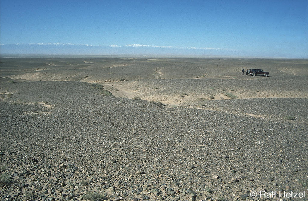
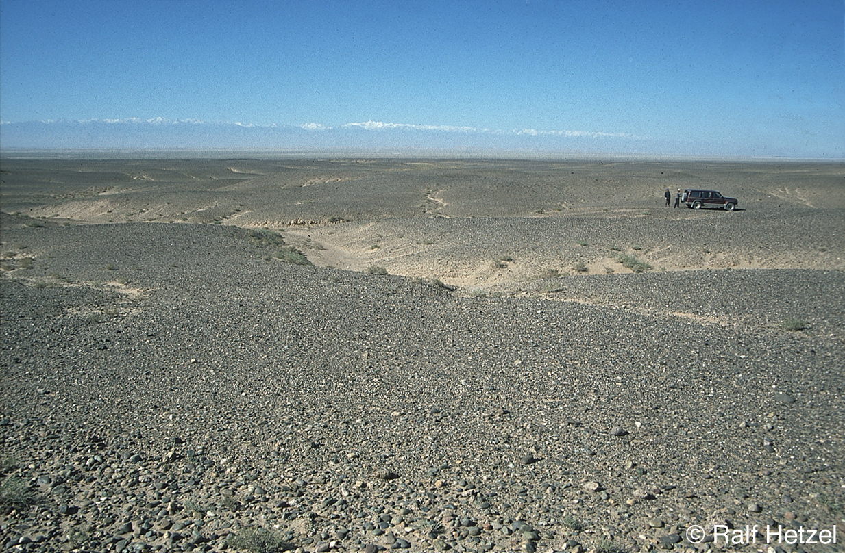
Sequence of river terraces in the hanging wall of an active thrust (Yumen thrust) in the foreland of NE Tibet. The thrust fault runs along the boundary between the terraces and the flat area with the trees. Surface exposure dating using the cosmogenic nuclides 21Ne, 10Be, and 26Al revealed remarkably old ages for the different terraces (40 ka to 170 ka) and a low fault slip rate of only 0.3-0.4 mm/a.
Related Publications:
Hetzel R., Niedermann S., Tao M., Kubik P.W., Ivy-Ochs S., Gao B., Strecker M.R. (2002). Low slip rates and long-term preservation of geomorphic features in Central Asia. Nature 417, 428-432.
Hetzel R., Niedermann S., Ivy-Ochs S., Kubik P.W., Tao M., Gao B. (2002). 21Ne versus 10Be and 26Al exposure ages of fluvial terraces: the influence of crustal Ne in quartz. Earth and Planetary Science Letters 201, 575-591.
Download full size image (1,2 MB)
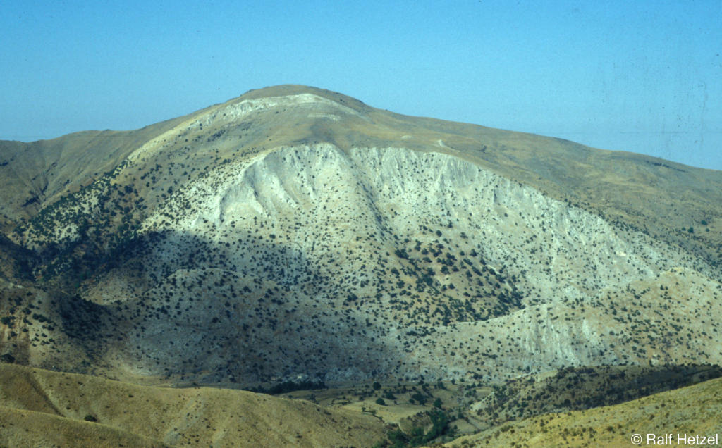
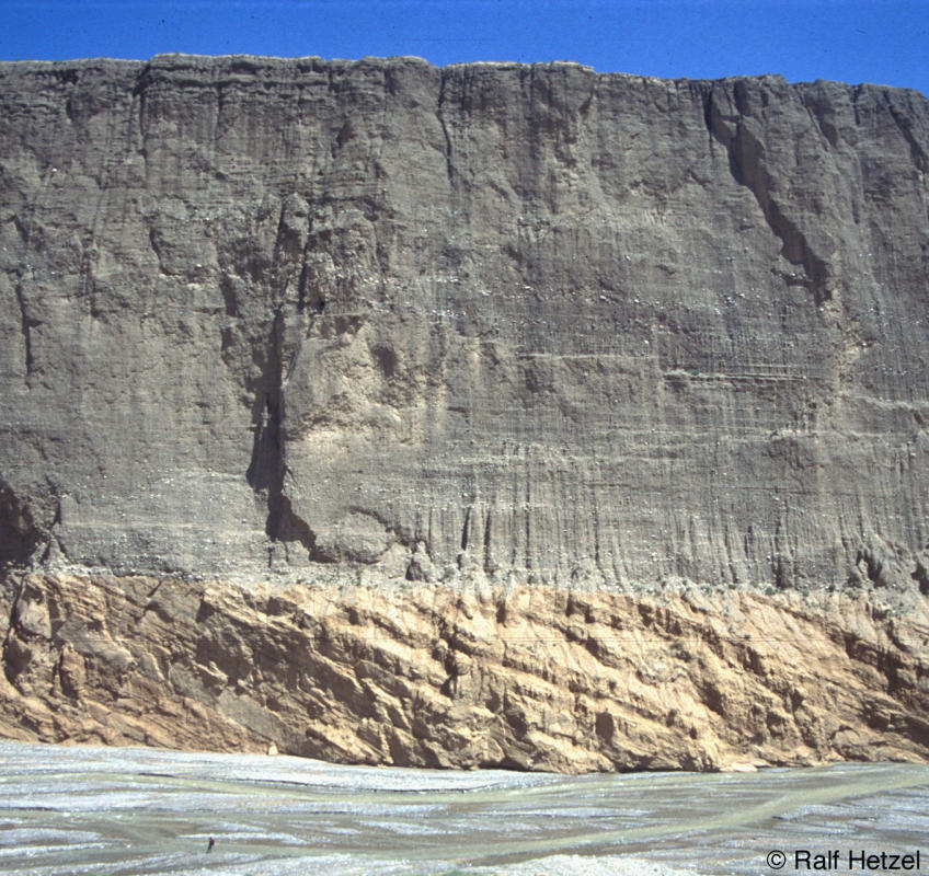
An extensive Quaternary alluvial fan surface in the arid foreland of the Qilian Shan. Surface exposure dating of the tectonically tilted alluvial fan surface yielded an age of ~230 ka. The snow-covered mountains in the background are the 5500-m-high peaks of the Qilian Shan. View is toward the SSW.
Related Publications:
Hetzel R., Tao, M., Niedermann S., Strecker M.R., Ivy-Ochs S., Kubik P.W., Bo G (2004). Implications of the fault scaling law for the growth of topography: Mountain ranges in the broken foreland of NE Tibet, Terra Nova 16, 157-162.

Download full size image (798 KB)
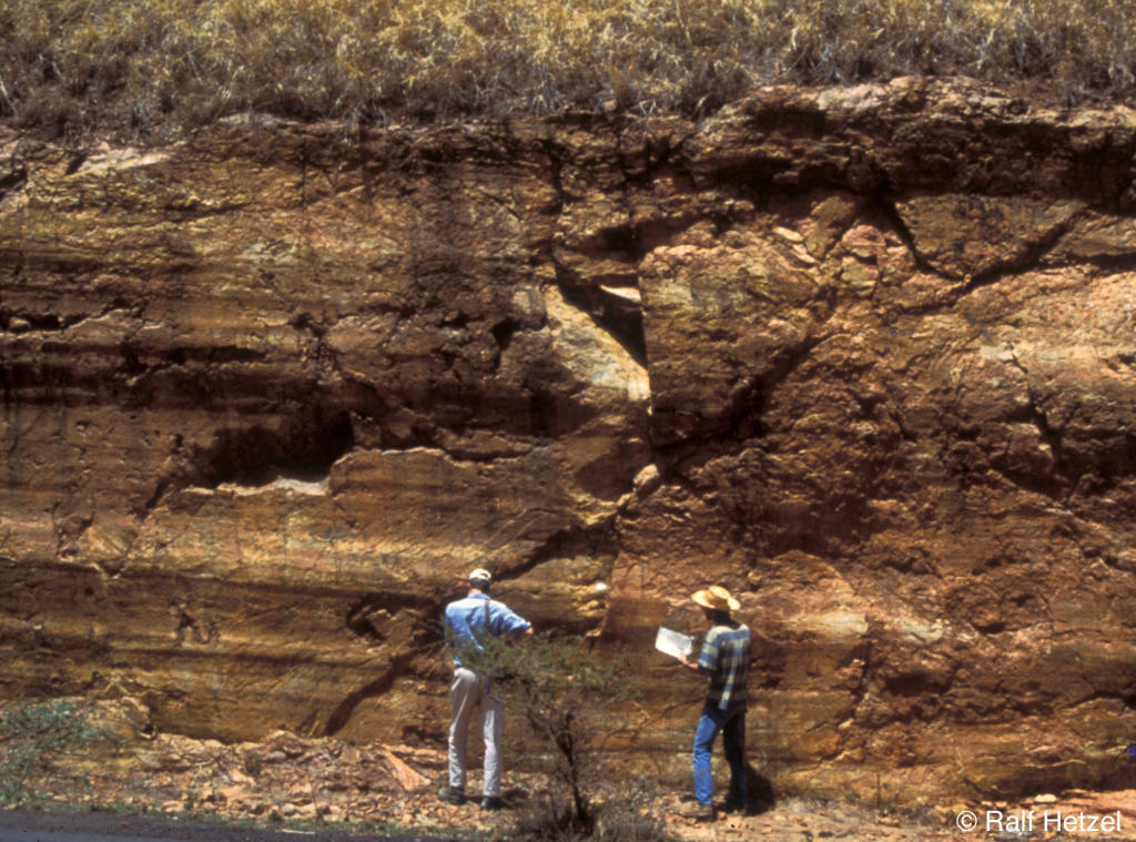
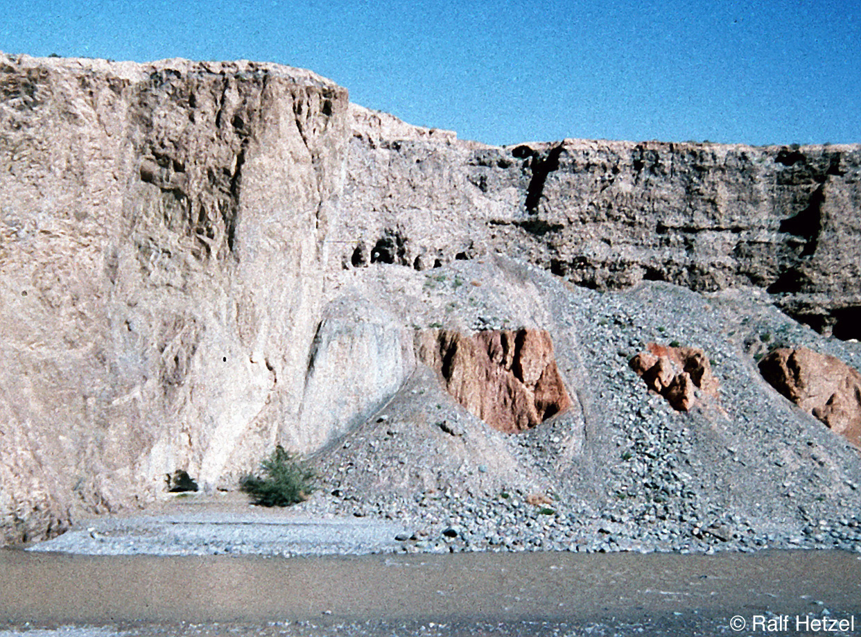
Thrust fault exposed in a ~40-m-high cliff of a major river at the mountain front of the Qilian Shan. Ordovician metasediments in the foot wall are placed against Neogene red beds and grey Late Quaternary conglomerates in the hanging wall. A thin Holocene loess cover is present on both foot and hanging wall of the fault. The colluvial wedge of loess on the hanging wall demonstrates that the fault is active.
Related Publications:
Hetzel R., Tao M., Stokes S., Niedermann S., Ivy-Ochs S., Bo G., Strecker M.R., Kubik P.W. (2004). Late Pleistocene/Holocene slip rate of the Zhangye thrust (Qilian Shan, China) and implications for the active growth of the northeastern Tibetan Plateau, Tectonics 23 (6), TC6006, doi:10.1029/2004TC001653.
Stokes S., Hetzel R., Bailey, R.M., Tao M. (2003). Combined IRSL-OSL single aliquot regeneration (SAR) equivalent dose (De) estimates from source proximal Chinese loess. Quaternary Science Reviews 22, 975-983.

Download full size image (722 KB)
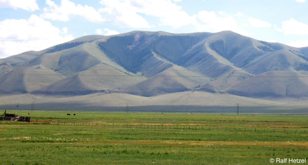
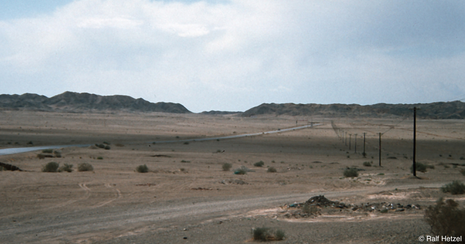
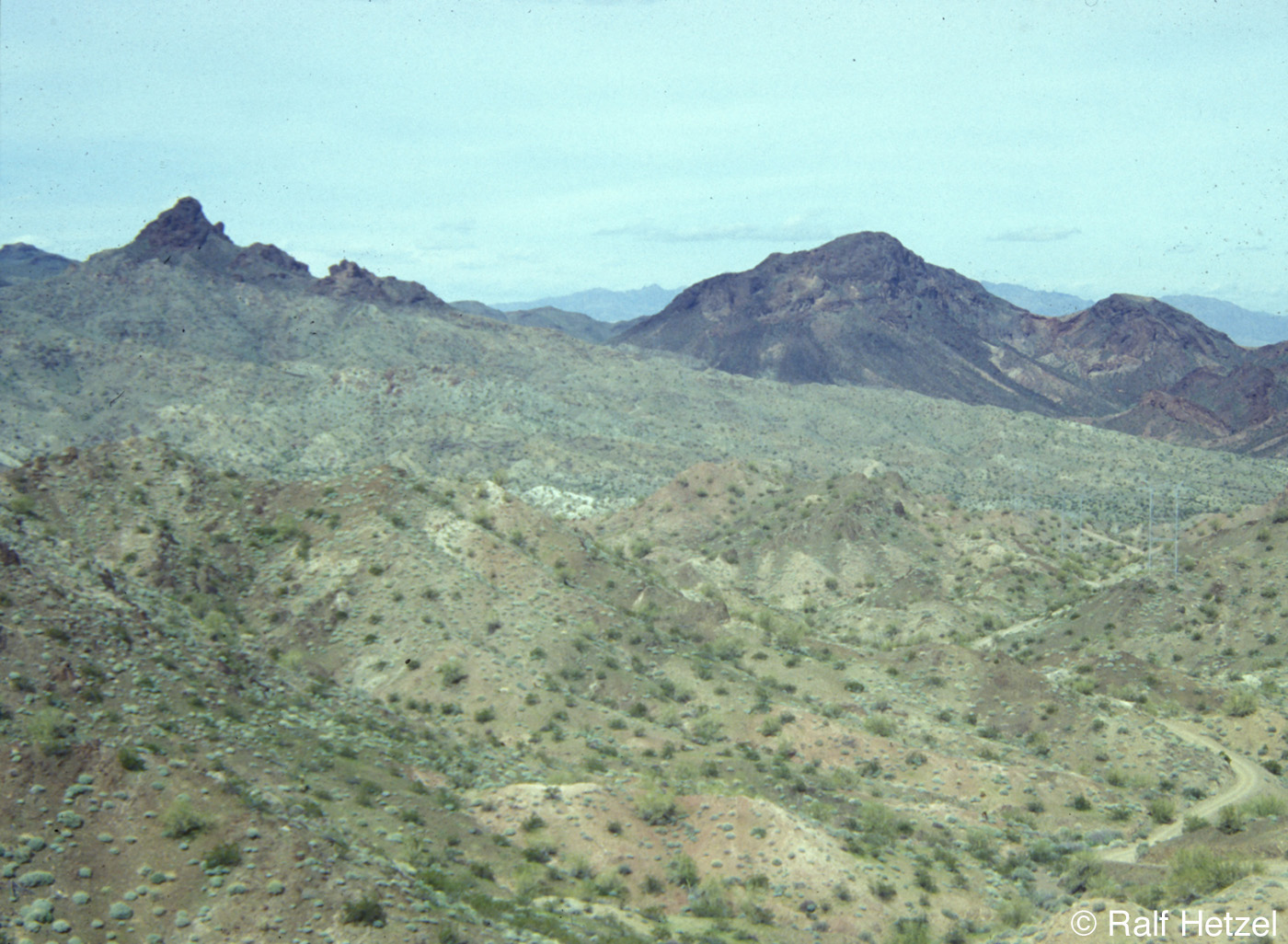
Wind gap in the broken foreland of the Qilian Shan, where active reverse faults lead to the growth of mountain ranges. Wind gaps are abandoned river valleys that form when river incision cannot keep pace with tectonic uplift. As a result, rivers are forced to flow subparallel to actively growing folds or mountain chains until they reach a low point where they can traverse the laterally growing structures.
Related Publications:
Hetzel R., Tao, M., Niedermann S., Strecker M.R., Ivy-Ochs S., Kubik P.W., Bo G (2004). Implications of the fault scaling law for the growth of topography: Mountain ranges in the broken foreland of NE Tibet, Terra Nova 16, 157-162.

Download full size image (1,3 MB)
Spectacular, regionally exposed detachment fault in the Menderes Massif (SW Turkey). The detachment dips 15° to the NNE (right side of picture). Dark rocks in the foreground are cataclasites below the detachment, which were derived from greenschist-facies metasediments. In the background tilted Neogene sediments are placed tectonically on the detachment fault.
Related Publications:
Hetzel R., Ring U., Akal C., Troesch M. (1995). Miocene NNE-directed extensional unroofing in the Menderes Massif, SW Turkey. Journal of the Geological Society of London 152, 639-654.
Download full size image (1,1 MB)
Large anticline in the central Menderes Massif. White marble in the core of the anticline is exposed over a vertical distance of ~200 m and overlain by intensely deformed greenschist-facies schists and quartzites. The fold axis coincides with a regional structural boundary that separates two domains which experienced an opposite sense of shear during Miocene extensional deformation.
Related Publications:
Hetzel R., Passchier C.W., Ring U., Dora O.Ö. (1995). Bivergent extension in orogenic belts: The Menderes Massif (SW Turkey). Geology 23, 455-458.

Download full size image (1,3 MB)
Bedrock fault scarp in limestones in central Crete. View is along strike of the normal fault toward the north.
Download full size image (1,6 MB)
Strike-slip fault in high-grade basement rocks (northern Kenya Rift). Well-developed striations and groove marks indicate that the relative movement along the fault is horizontal. Inherited structures like this one played a major role during the evolution of the Cenozoic Kenya Rift.
Related Publications:
Hetzel R., Strecker M.R. (1994). Late Mozambique Belt structures in western Kenya and their influence on the evolution of the Cenozoic Kenya Rift. Journal of Structural Geology 16, 189-201.

Download full size image (1,3 MB)
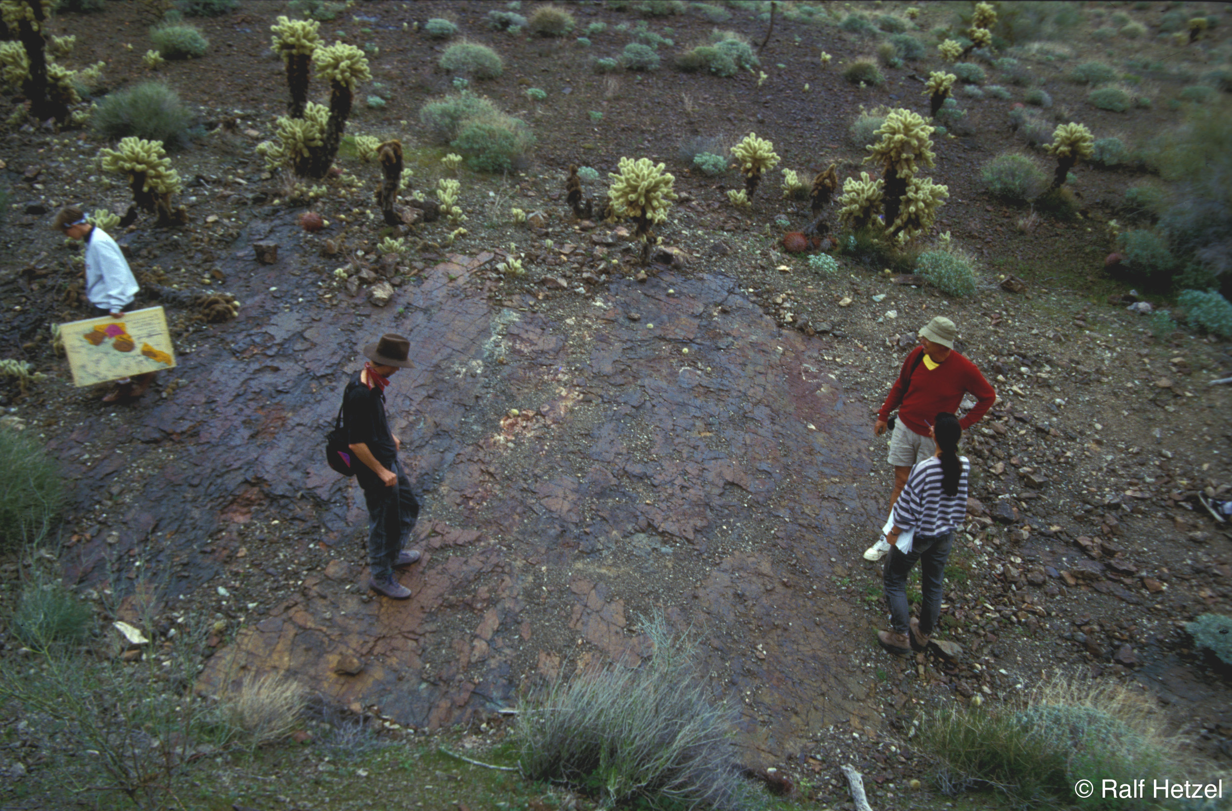
Fill terrace along the Shiyou River in the western Qilian Shan. The terrace is postglacial in age and located ~125 m above the river. For a detailed view of the unconformity at the base of the terrace fill see Picture 11b.
Related Publications:
Hetzel R., Niedermann S., Tao M., Kubik P.W., Strecker M.R. (2006). Climatic versus tectonic control on river incision at the margin of NE Tibet: 10Be exposure dating of river terraces at the mountain front of the Qilian Shan. Journal of Geophysical Research ? Earth Surface, 111, F03012, doi:10.1029/2005JF000352.
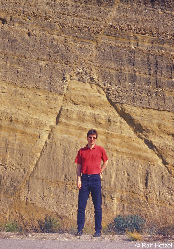
Download full size image (2,2 MB)
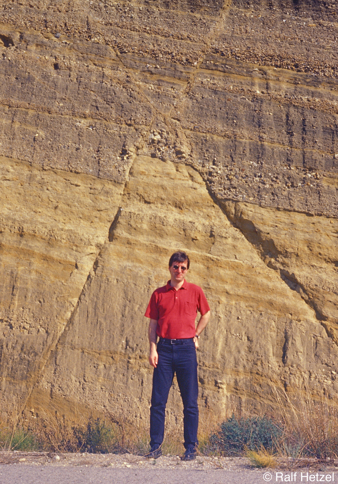
Angular unconformity between Neogene red beds and Late Quaternary conglomerates which constitute the fill of a prominent terrace located ~125 m abouve the Shiyou River. Person in lower left provides scale. For an overview of the terrace see Picture 11a.
Related Publications:
Hetzel R., Niedermann S., Tao M., Kubik P.W., Strecker M.R. (2006). Climatic versus tectonic control on river incision at the margin of NE Tibet: 10Be exposure dating of river terraces at the mountain front of the Qilian Shan. Journal of Geophysical Research ? Earth Surface, 111, F03012, doi:10.1029/2005JF000352.

Download full size image (447 KB)
Classic view of the low-angle normal fault in the Whipple mountains, California. The detachment fault separates mylonitic gneisses in the foot wall from tilted volcanic rocks in the hanging wall and has a displacement of several tens of kilometres.

Download full size image (1,3 MB)
View on a polished and striated part of the Whipple detachment fault. The rocks are intensely deformed cataclasites.
Download full size image (1,3 MB)
Two conjugate normal faults in Neogene sediments of the Betic Cordillera (southern Spain).

Download full size image (3,3 MB)
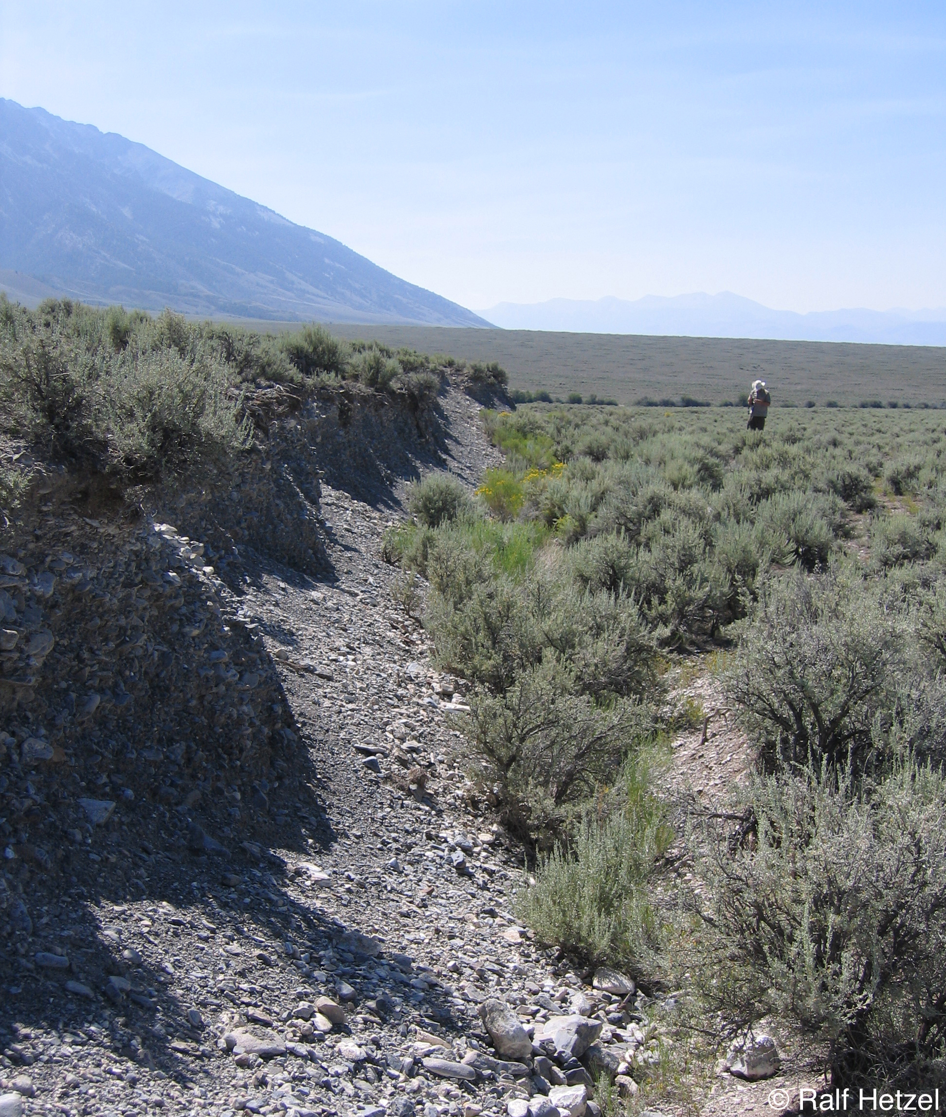
View along the fault scarp that was largely generated during the 1983 Borah Peak earthquake in Idaho. Range-bounding normal fault scarps such as this are typical for the actively growing mountain ranges in the northern Basin and Range province. Picture was taken in 2004.
Related Publications:
Densmore A.L., Dawers N.H., Gupta S., Guidon R., Goldin T. (2004). Footwall topographic development during continental extension. Journal of Geophysical Research, 109, F03001, doi:10.1029/2003JF000115.
Download full size image (882 KB)
Normal fault (Red Rock fault) with prominent triangular facets bounding the Tendoy Range in Idaho. A late Quaternary fault scarp extends along the base of the range just above the alluvial fans.
Related Publications:
Densmore A.L., Dawers N.H., Gupta S., Guidon R., Goldin T. (2004). Footwall topographic development during continental extension. Journal of Geophysical Research, 109, F03001, doi:10.1029/2003JF000115.